Arlington, Tennessee Map and Directory
Regional Directory > States Menu > Tennessee
 According to the United States Census Bureau, Arlington is a Town that is located in Shelby County, Tennessee at 35.30 degrees North and 89.66 degrees West.
The town's time zone is America/Chicago, and the town's primary telephone area code is 901.
The land area of Arlington is about 23.06 square miles, whereas the water area of the town is about 0.01 square miles.
Shelby County's land area is about 763 square miles, so the town occupies about 3.0 percent of the county's total land area.
According to the United States Census Bureau, Arlington is a Town that is located in Shelby County, Tennessee at 35.30 degrees North and 89.66 degrees West.
The town's time zone is America/Chicago, and the town's primary telephone area code is 901.
The land area of Arlington is about 23.06 square miles, whereas the water area of the town is about 0.01 square miles.
Shelby County's land area is about 763 square miles, so the town occupies about 3.0 percent of the county's total land area.
The Census Bureau estimates that Arlington had about 11,743 residents in 2019, which is approximately 509 people per square mile of land area.
According to recent American Community Survey data, the median household income in Arlington was about $102,114 per year.
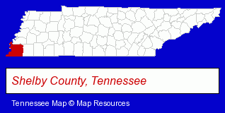
The Tennessee counties map at upper right shows Shelby County, highlighted in red. Use the menu below to display interactive maps of Arlington, either in a frame on this page or in full-screen mode.
Use the menu below to display categorized Arlington directories.
| Arlington Products and Services Directory | |
|---|---|
| Home Improvement | Landscape Contractors |
Selected Arlington, Tennessee Listings
These representative Arlington listings provide some insight into the town's cultural environment and economic climate.- Florists
- Gift Shops
- Landscape Services
- Lawn & Garden Services
- Garden Centers
- Masonry Contractors
- Insurance
- Pest Control Services
- Pest Control Services Commercial & Industrial
- Termite Control
- Lawn & Garden Services
- Nurseries
- Pet Care Services
- Pet Grooming & Boarding
- Pet Training
- Animals Specialty Services
- Auto Service & Repair
- Brake Service & Repair
- Auto Tire Shop Equipment & Supplies
- Chiropractors
Nearby Tennessee Cities and Towns *
- Bartlett (2) - Bartlett, Tennessee information and maps.
- Clarksville (22) - Clarksville, Tennessee solutions directory and maps.
- Collierville (7) - Collierville, Tennessee demographics and maps.
- Franklin (32) - Franklin, Tennessee solutions directory and maps.
- Germantown (9) - Germantown, Tennessee demographics and directory.
- Jackson (15) - Jackson, Tennessee demographics and directory.
- Memphis (111) - Memphis, Tennessee products & services directory.
* Parenthesized numbers indicate economic activity levels.
Copyright © 2011-2026 RegionalDirectory.us. All rights reserved.