Cleveland, Tennessee Map and Directory
Regional Directory > States Menu > Tennessee
 According to the United States Census Bureau, Cleveland is a City that is located in Bradley County, Tennessee at 35.16 degrees North and 84.88 degrees West.
The city's time zone is America/New York, and the city's primary telephone area code is 423.
The land area of Cleveland is about 26.89 square miles, whereas the water area of the city is about 0.01 square miles.
Bradley County's land area is about 329 square miles, so the city occupies about 8.2 percent of the county's total land area.
According to the United States Census Bureau, Cleveland is a City that is located in Bradley County, Tennessee at 35.16 degrees North and 84.88 degrees West.
The city's time zone is America/New York, and the city's primary telephone area code is 423.
The land area of Cleveland is about 26.89 square miles, whereas the water area of the city is about 0.01 square miles.
Bradley County's land area is about 329 square miles, so the city occupies about 8.2 percent of the county's total land area.
The Census Bureau estimates that Cleveland had about 45,504 residents in 2019, which is approximately 1,692 people per square mile of land area.
According to recent American Community Survey data, the median household income in Cleveland was about $44,633 per year.
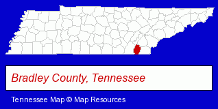
The Tennessee counties map at upper right shows Bradley County, highlighted in red. Use the menu below to display interactive maps of Cleveland, either in a frame on this page or in full-screen mode.
Use the menu below to display categorized Cleveland directories.
| Cleveland Products and Services Directory | ||
|---|---|---|
| Attorneys | Auto Dealers | Clinics |
| Cremation Services | Dentists | Home Improvement |
| Physicians | Veterinarians | |
Selected Cleveland, Tennessee Listings
These randomly selected Cleveland listings provide some insight into the city's cultural environment and economic climate.- Auto Parts Retail
- Auto Accessories Retail
- Homes & Residential Real Estate
- Property Management
- Shopping Centers & Malls
- Pediatrics Physicians & Surgeons
- General Practice
- Nurses
- Nurse Practitioners
- Camps
- Party Equipment & Supplies Sales & Rental
- Sporting Goods
- Tool Rental & Leasing
- Camping Equipment & Supplies Dealers
- Accountants
- Accounting, Auditing & Bookkeeping Services
- Certified Public Accountants
- Tax Return Preparation
- Optometrists
- Optical Goods Retail
- General Practice
- Contact Lenses
- Funeral Services
- Funeral Homes & Directors
- Cremation Services
- Animal Hospitals
- Animal Health
- Pedodontics Dentists
- Cosmetic & Reconstructive Surgeons
- General Practice
- Skin Care
- Corporate Business Attorneys
- Bankruptcy Attorneys
- Social Security Attorneys
- Administrative & Governmental Law Attorneys
- Shoe Stores
- Formal Wear Sales & Rental
- Mortgages
- Real Estate Loans
- Escrow Services
- Mortgage Brokers
Nearby Tennessee Cities and Towns *
- Athens (2) - Athens, Tennessee information and maps.
- Chattanooga (58) - Chattanooga, Tennessee products & services directory.
- Cookeville (8) - Cookeville, Tennessee demographics and maps.
- Crossville (5) - Crossville, Tennessee demographics and maps.
- Knoxville (96) - Knoxville, Tennessee products & services directory.
- Maryville (14) - Maryville, Tennessee demographics and directory.
- Oak Ridge (7) - Oak Ridge, Tennessee demographics and maps.
Large and Mid-size Cities in Nearby States
- Dalton, Georgia (6) - Dalton, GA information and maps.
* Parenthesized numbers indicate economic activity levels.
Copyright © 2011-2026 RegionalDirectory.us. All rights reserved.