Magnolia, Texas Map and Directory
Regional Directory > States Menu > Texas
 According to the United States Census Bureau, Magnolia is a City that is located in Montgomery County, Texas at 30.21 degrees North and 95.75 degrees West.
The city's time zone is America/Chicago, and the city's primary telephone area code is 832.
The land area of Magnolia is about 2.83 square miles, whereas the water area of the city is about 0.01 square miles.
Montgomery County's land area is about 1,042 square miles, so the city occupies about 0.3 percent of the county's total land area.
According to the United States Census Bureau, Magnolia is a City that is located in Montgomery County, Texas at 30.21 degrees North and 95.75 degrees West.
The city's time zone is America/Chicago, and the city's primary telephone area code is 832.
The land area of Magnolia is about 2.83 square miles, whereas the water area of the city is about 0.01 square miles.
Montgomery County's land area is about 1,042 square miles, so the city occupies about 0.3 percent of the county's total land area.
The Census Bureau estimates that Magnolia had about 1,654 residents in 2014, which is approximately 584 people per square mile of land area.
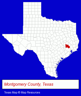
The Texas counties map at upper right shows Montgomery County, highlighted in red. Use the menu below to display interactive maps of Magnolia, either in a frame on this page or in full-screen mode.
Use the menu below to display categorized Magnolia directories.
| Magnolia Directory Page: | Water Utility Companies |
|---|
Selected Magnolia, Texas Listings
These Magnolia listings provide some insight into the city's cultural environment and economic climate.- Metals
- Office Building & Industrial Cleaning Services
- Janitorial Services
- Interior Building Cleaning
- Steak Restaurants
- American Restaurants
- Metal Fabricators
- Welding Services
- Outdoor Sports & Recreation
- Public Golf Courses
- Golf
- Golf Courses
- Golf Instruction
- Sporting Goods Dealers
- Fishing Equipment & Supplies Dealers
- Fishing Bait & Tackle
- Embroidery & Needlework
- Embroidery Service
- Pet Training
- Pet Related Services
- Water & Sewage Companies
- Water Utility Companies
Nearby Texas Cities and Towns *
- Conroe (17) - Conroe, Texas solutions directory and maps.
- Katy (26) - Katy, Texas solutions directory and maps.
- Montgomery (6) - Montgomery, Texas demographics and maps.
- Spring (43) - Spring, Texas products & services directory.
- The Woodlands (4) - The Woodlands, Texas information and maps.
- Tomball (9) - Tomball, Texas demographics and directory.
- Waller (1) - Waller, Texas information and maps.
* Parenthesized numbers indicate economic activity levels.
Copyright © 2011-2026 RegionalDirectory.us. All rights reserved.