Montgomery, Texas Map and Directory
Regional Directory > States Menu > Texas
 According to the United States Census Bureau, Montgomery is a City that is located in Montgomery County, Texas at 30.39 degrees North and 95.70 degrees West.
The city's time zone is America/Chicago, and the city's primary telephone area code is 936.
The land area of Montgomery is about 4.71 square miles, whereas the water area of the city is about 0.08 square miles.
Montgomery County's land area is about 1,042 square miles, so the city occupies about 0.5 percent of the county's total land area.
According to the United States Census Bureau, Montgomery is a City that is located in Montgomery County, Texas at 30.39 degrees North and 95.70 degrees West.
The city's time zone is America/Chicago, and the city's primary telephone area code is 936.
The land area of Montgomery is about 4.71 square miles, whereas the water area of the city is about 0.08 square miles.
Montgomery County's land area is about 1,042 square miles, so the city occupies about 0.5 percent of the county's total land area.
The Census Bureau estimates that Montgomery had about 710 residents in 2014, which is approximately 151 people per square mile of land area.
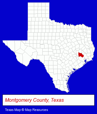
The Texas counties map at upper right shows Montgomery County, highlighted in red. Use the menu below to display interactive maps of Montgomery, either in a frame on this page or in full-screen mode.
Use the menu below to display categorized Montgomery directories.
| Montgomery Products and Services Directory | ||
|---|---|---|
| Animal Hospitals | Home Improvement | Hotels |
| Physicians | Restaurants | Veterinarians |
Selected Montgomery, Texas Listings
These randomly selected Montgomery listings provide some insight into the city's cultural environment and economic climate.- Boarding Stables
- Equestrian Sports & Recreation
- Horseback Riding
- Marinas
- Water Transportation
- Boarding Stables
- Horseback Riding
- Horse Farms & Equipment & Supplies Dealers
- Clothing Stores
- Building & Home Construction
- Building Contractors
- Nutritionists
- Health Food Stores
- Printing Services
- Screen Printing
- Copying & Duplicating Services
- Signs Wholesale & Manufacturers
- Caterers
- Banquet Facilities
- Pizza Restaurants
- Alternative Medicine
- Chiropractors
- Alternative Medicine Practitioners
- Clinics
- Osteopathic Physicians & Surgeons
- Family & General Practice Physicians & Surgeons
- Homes & Residential Real Estate
- Hotels
- Resorts & Vacation Cottages
- Dentists
Nearby Texas Cities and Towns *
- Conroe (17) - Conroe, Texas solutions directory and maps.
- Huntsville (1) - Huntsville, Texas information and maps.
- Magnolia (1) - Magnolia, Texas information and maps.
- Spring (43) - Spring, Texas products & services directory.
- The Woodlands (4) - The Woodlands, Texas information and maps.
- Tomball (9) - Tomball, Texas demographics and directory.
- Waller (1) - Waller, Texas information and maps.
* Parenthesized numbers indicate economic activity levels.
Copyright © 2011-2026 RegionalDirectory.us. All rights reserved.