Marble Falls, Texas Map and Directory
Regional Directory > States Menu > Texas
 According to the United States Census Bureau, Marble Falls is a City that is located in Burnet County, Texas at 30.58 degrees North and 98.27 degrees West.
The city's time zone is America/Chicago, and the city's primary telephone area code is 830.
The land area of Marble Falls is about 13.09 square miles, whereas the water area of the city is about 0.65 square miles.
Burnet County's land area is about 994 square miles, so the city occupies about 1.3 percent of the county's total land area.
According to the United States Census Bureau, Marble Falls is a City that is located in Burnet County, Texas at 30.58 degrees North and 98.27 degrees West.
The city's time zone is America/Chicago, and the city's primary telephone area code is 830.
The land area of Marble Falls is about 13.09 square miles, whereas the water area of the city is about 0.65 square miles.
Burnet County's land area is about 994 square miles, so the city occupies about 1.3 percent of the county's total land area.
The Census Bureau estimates that Marble Falls had about 7,038 residents in 2019, which is approximately 538 people per square mile of land area.
According to recent American Community Survey data, the median household income in Marble Falls was about $43,793 per year. This Marble Falls Real Estate directory lists real estate solution providers in Marble Falls, Texas.
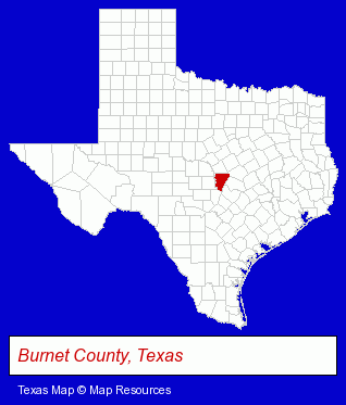
The Texas counties map at upper right shows Burnet County, highlighted in red. Use the menu below to display interactive maps of Marble Falls, either in a frame on this page or in full-screen mode.
Use the menu below to display categorized Marble Falls directories.
| Marble Falls Directory Page: | Restaurants |
|---|
Selected Marble Falls, Texas Listings
These Marble Falls listings provide some insight into the city's cultural environment and economic climate.- Take Out
- Limousine Services
- Taxi Services
- Taxicab Brokers
- Museums
- Printing Services
- Screen Printing
- Copying & Duplicating Services
- Copiers & Supplies
- Home Improvement & Maintenance
- Swimming Pool & Spa Construction & Contractors
- Spa & Hot Tub Service & Repair
- Family & General Practice Physicians & Surgeons
- Internal Medicine Physicians & Surgeons
- Retirement Communities & Homes
- Retirement & Life Care Centers
- Retirement Planning Consultants & Services
- Clinics & Medical Centers
- Civil Engineers
Nearby Texas Cities and Towns *
- Austin (207) - Austin, Texas products & services directory.
- Blanco (1) - Blanco, Texas information and maps.
- Cedar Park (6) - Cedar Park, Texas demographics and maps.
- Fredericksburg (6) - Fredericksburg, Texas demographics and maps.
- Georgetown (9) - Georgetown, Texas demographics and directory.
- Round Rock (19) - Round Rock, Texas solutions directory and maps.
- West Lake Hills (4) - West Lake Hills, Texas information and maps.
* Parenthesized numbers indicate economic activity levels.
Copyright © 2011-2026 RegionalDirectory.us. All rights reserved.