Port Aransas, Texas Map and Directory
Regional Directory > States Menu > Texas
 According to the United States Census Bureau, Port Aransas is a City that is located in Nueces County, Texas at 27.83 degrees North and 97.06 degrees West.
The city's time zone is America/Chicago, and the city's primary telephone area code is 361.
The land area of Port Aransas is about 8.94 square miles, whereas the water area of the city is about 5.13 square miles.
Nueces County's land area is about 838 square miles, so the city occupies about 1.1 percent of the county's total land area.
According to the United States Census Bureau, Port Aransas is a City that is located in Nueces County, Texas at 27.83 degrees North and 97.06 degrees West.
The city's time zone is America/Chicago, and the city's primary telephone area code is 361.
The land area of Port Aransas is about 8.94 square miles, whereas the water area of the city is about 5.13 square miles.
Nueces County's land area is about 838 square miles, so the city occupies about 1.1 percent of the county's total land area.
The Census Bureau estimates that Port Aransas had about 3,876 residents in 2014, which is approximately 434 people per square mile of land area.
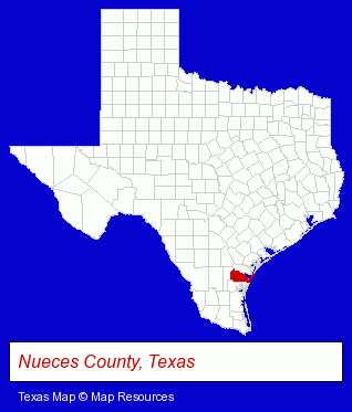
The Texas counties map at upper right shows Nueces County, highlighted in red. Use the menu below to display interactive maps of Port Aransas, either in a frame on this page or in full-screen mode.
Use the menu below to display categorized Port Aransas directories.
| Port Aransas Products and Services Directory | ||
|---|---|---|
| Hotels | Restaurants | Vacation Home Rental |
Selected Port Aransas, Texas Listings
These representative Port Aransas listings provide some insight into the city's cultural environment and economic climate.- Motels
- Cabin, Cottage & Chalet Rental
- Steak Restaurants
- Caterers
- Bar & Grill Restaurants
- Bars & Pubs
- Gift Shops
- Caterers
- Pizza Restaurants
- Take Out
- Pizza Wholesale & Manufacturers
- Sporting Goods Dealers
- Fishing Equipment & Supplies Dealers
- Fishing Bait & Tackle
- Geologists
- Geological Services
- Resorts & Vacation Cottages
- Condominium & Townhouse Rental & Leasing
- Lodging
- Hotels
- Motels
- Homes & Residential Real Estate
- Real Estate Rental & Leasing
- Property Management
- Vacation Home Rental
- Condominium & Townhouse Management
- Mexican Restaurants
Nearby Texas Cities and Towns *
- Corpus Christi (54) - Corpus Christi, Texas products & services directory.
- Rockport (2) - Rockport, Texas information and maps.
- Victoria (14) - Victoria, Texas demographics and directory.
* Parenthesized numbers indicate economic activity levels.
Copyright © 2011-2026 RegionalDirectory.us. All rights reserved.