Victoria, Texas Map and Directory
Regional Directory > States Menu > Texas
 According to the United States Census Bureau, Victoria is a City that is located in Victoria County, Texas at 28.81 degrees North and 97.00 degrees West.
The city's time zone is America/Chicago, and the city's primary telephone area code is 361.
The land area of Victoria is about 37.01 square miles, whereas the water area of the city is about 0.15 square miles.
Victoria County's land area is about 882 square miles, so the city occupies about 4.2 percent of the county's total land area.
According to the United States Census Bureau, Victoria is a City that is located in Victoria County, Texas at 28.81 degrees North and 97.00 degrees West.
The city's time zone is America/Chicago, and the city's primary telephone area code is 361.
The land area of Victoria is about 37.01 square miles, whereas the water area of the city is about 0.15 square miles.
Victoria County's land area is about 882 square miles, so the city occupies about 4.2 percent of the county's total land area.
The Census Bureau estimates that Victoria had about 66,916 residents in 2019, which is approximately 1,808 people per square mile of land area.
According to recent American Community Survey data, the median household income in Victoria was about $54,192 per year.
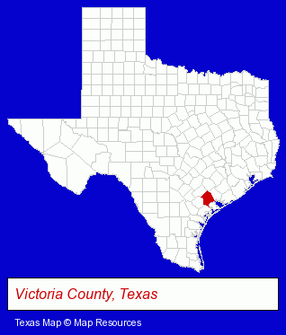
The Texas counties map at upper right shows Victoria County, highlighted in red. Use the menu below to display interactive maps of Victoria, either in a frame on this page or in full-screen mode.
Use the menu below to display categorized Victoria directories.
| Victoria Products and Services Directory | ||
|---|---|---|
| Auto Service | Building Materials | Ceramic Tiles |
| Clinics | Fast Food Restaurants | Home Improvement |
| Jewelers | Jewelry Repair | Metals |
| Moving and Storage | Paint Stores | Physicians |
| Restaurants | Visual Arts | |
Selected Victoria, Texas Listings
These randomly selected Victoria listings provide some insight into the city's cultural environment and economic climate.- Building & Home Construction
- Builders & Contractors
- Building Contractors
- Clothing Stores
- T-Shirts Retail
- Consumer Electronics Stores
- Computer Hardware & Supplies
- Cameras & Camera Supplies
- Electronics
- Digital Cameras
- Recreation Centers
- Bowling Alleys
- Trailers Wholesale & Manufacturers
- Take Out
- Fast Food Restaurants
- Ice Cream & Frozen Yogurt Shops
- Plastic & Plastic Products Wholesale & Manufacturers
- Lodging
- Hotels
- Motels
- Auto Glass Retail
- Auto Glass Replacement & Repair
- Window Repair & Replacement
- Dentists
- Clinics & Medical Centers
- Chiropractors
- Pain Management Physicians & Surgeons
- Beauty Salons
- Hair Removal
- Electrolysis Treatments
- Permanent Make Up
- Allergy & Immunology Physicians & Surgeons
- Internet Products & Services
- Web Site Design
- Web Sites
- Web Site Developers
- Homes & Residential Real Estate
- Real Estate Investments
- Condominium & Townhouse Management
Nearby Texas Cities and Towns *
- Bay City (1) - Bay City, Texas information and maps.
- Columbus (2) - Columbus, Texas information and maps.
- Corpus Christi (54) - Corpus Christi, Texas products & services directory.
- Port Aransas (3) - Port Aransas, Texas information and maps.
- Rockport (2) - Rockport, Texas information and maps.
* Parenthesized numbers indicate economic activity levels.
Copyright © 2011-2026 RegionalDirectory.us. All rights reserved.