Port Arthur, Texas Map and Directory
Regional Directory > States Menu > Texas
 According to the United States Census Bureau, Port Arthur is a City that is located primarily in Jefferson County, Texas at 29.83 degrees North and 93.97 degrees West.
The city's time zone is America/Chicago, and the city's primary telephone area code is 409.
The land area of Port Arthur is about 76.92 square miles, whereas the water area of the city is about 67.25 square miles.
According to the United States Census Bureau, Port Arthur is a City that is located primarily in Jefferson County, Texas at 29.83 degrees North and 93.97 degrees West.
The city's time zone is America/Chicago, and the city's primary telephone area code is 409.
The land area of Port Arthur is about 76.92 square miles, whereas the water area of the city is about 67.25 square miles.
The Census Bureau estimates that Port Arthur had about 54,280 residents in 2019, which is approximately 706 people per square mile of land area.
According to recent American Community Survey data, the median household income in Port Arthur was about $36,557 per year.
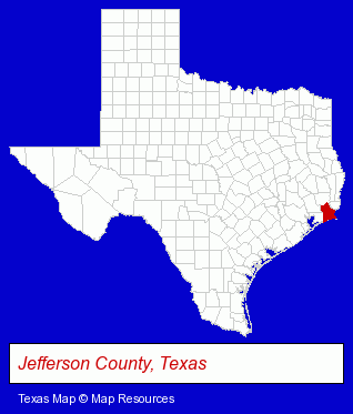
The Texas counties map at upper right shows Jefferson County, highlighted in red. Use the menu below to display interactive maps of Port Arthur, either in a frame on this page or in full-screen mode.
Use the menu below to display categorized Port Arthur directories.
| Port Arthur Directory Page: | Home Improvement |
|---|
Selected Port Arthur, Texas Listings
These Port Arthur listings in zipcode 77642 provide a window into the city's cultural environment and economic climate. A-1 Tint & Accessories- Window Glass Coating & Tinting
- Truck Parts & Equipment Wholesale & Manufacturers
- Custom Car Parts & Accessories
- Builders & Contractors
- Building Contractors
- Department Stores
- Computers & Equipment Repair & Maintenance
- Adult & Continuing Education
- Computer Networks
- Career & Workplace Education
- Computer Training
- Credit Unions
Nearby Texas Cities and Towns *
- Baytown (5) - Baytown, Texas demographics and maps.
- Beaumont (23) - Beaumont, Texas solutions directory and maps.
- Galveston (8) - Galveston, Texas demographics and maps.
- Kemah (2) - Kemah, Texas information and maps.
- Orange (3) - Orange, Texas information and maps.
- Texas City (3) - Texas City, Texas information and maps.
- Webster (7) - Webster, Texas demographics and maps.
Large and Mid-size Cities in Nearby States
- Lake Charles, Louisiana (18) - Lake Charles, LA demographics and directory.
* Parenthesized numbers indicate economic activity levels.
Copyright © 2011-2026 RegionalDirectory.us. All rights reserved.