Rosenberg, Texas Map and Directory
Regional Directory > States Menu > Texas
 According to the United States Census Bureau, Rosenberg is a City that is located in Fort Bend County, Texas at 29.56 degrees North and 95.81 degrees West.
The city's time zone is America/Chicago, and the city's primary telephone area code is 832.
The land area of Rosenberg is about 26.16 square miles, whereas the water area of the city is about 0.08 square miles.
Fort Bend County's land area is about 861 square miles, so the city occupies about 3.0 percent of the county's total land area.
According to the United States Census Bureau, Rosenberg is a City that is located in Fort Bend County, Texas at 29.56 degrees North and 95.81 degrees West.
The city's time zone is America/Chicago, and the city's primary telephone area code is 832.
The land area of Rosenberg is about 26.16 square miles, whereas the water area of the city is about 0.08 square miles.
Fort Bend County's land area is about 861 square miles, so the city occupies about 3.0 percent of the county's total land area.
The Census Bureau estimates that Rosenberg had about 38,307 residents in 2019, which is approximately 1,464 people per square mile of land area.
According to recent American Community Survey data, the median household income in Rosenberg was about $52,138 per year.
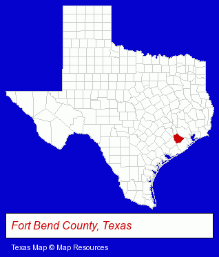
The Texas counties map at upper right shows Fort Bend County, highlighted in red. Use the menu below to display interactive maps of Rosenberg, either in a frame on this page or in full-screen mode.
Use the menu below to display categorized Rosenberg directories.
| Rosenberg Products and Services Directory | ||
|---|---|---|
| Auto Service | Home Improvement | Restaurants |
Selected Rosenberg, Texas Listings
These representative Rosenberg listings provide some insight into the city's cultural environment and economic climate.- Heating Contractors
- Roofing Contractors
- Building & Home Construction
- Builders & Contractors
- Roofing Contractors
- Roofing
- Truck Dealers
- Clothing & Accessories Retail
- Jewelers
- Diamonds Retail
- Gemstones Retail
- Accounting, Auditing & Bookkeeping Services
- Bookkeeping Services
- Diamonds Retail
- Watches Retail
- Schools
- Public Schools
- Spa & Hot Tub Dealers
- Agricultural Equipment & Supplies Retail
- Farm Equipment & Supplies Dealers
- Tractor Equipment & Parts Dealers
- Moving & Storage
- Building Materials & Supplies Wholesale & Manufacturers
Nearby Texas Cities and Towns *
- Bellaire (5) - Bellaire, Texas demographics and maps.
- Katy (26) - Katy, Texas solutions directory and maps.
- Missouri City (3) - Missouri City, Texas information and maps.
- Pearland (11) - Pearland, Texas demographics and directory.
- Richmond (6) - Richmond, Texas demographics and maps.
- Stafford (6) - Stafford, Texas demographics and maps.
- Sugar Land (22) - Sugar Land, Texas solutions directory and maps.
* Parenthesized numbers indicate economic activity levels.
Copyright © 2011-2026 RegionalDirectory.us. All rights reserved.