Stafford, Texas Map and Directory
Regional Directory > States Menu > Texas
 According to the United States Census Bureau, Stafford is a City that is located primarily in Fort Bend County, Texas at 29.63 degrees North and 95.57 degrees West.
The city's time zone is America/Chicago, and the city's primary telephone area code is 832.
The land area of Stafford is about 7.00 square miles, whereas the water area of the city is about 0.04 square miles.
According to the United States Census Bureau, Stafford is a City that is located primarily in Fort Bend County, Texas at 29.63 degrees North and 95.57 degrees West.
The city's time zone is America/Chicago, and the city's primary telephone area code is 832.
The land area of Stafford is about 7.00 square miles, whereas the water area of the city is about 0.04 square miles.
The Census Bureau estimates that Stafford had about 17,362 residents in 2019, which is approximately 2,480 people per square mile of land area.
According to recent American Community Survey data, the median household income in Stafford was about $62,264 per year.
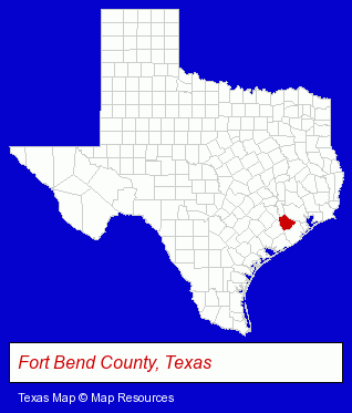
The Texas counties map at upper right shows Fort Bend County, highlighted in red. Use the menu below to display interactive maps of Stafford, either in a frame on this page or in full-screen mode.
Use the menu below to display categorized Stafford directories.
| Stafford Products and Services Directory | ||
|---|---|---|
| Air Conditioning | Building Materials | Business Services |
| Heating Contractors | Home Improvement | Metals |
Selected Stafford, Texas Listings
These randomly selected Stafford listings in 77477 provide a window into the city's cultural environment and economic climate. Atomic Cross Fit- Health Clubs & Gyms
- Recreation Centers
- Business Consultants & Advisors
- Dentists
- Building & Home Construction
- Heating & Air Conditioning Contractors
- Air Conditioning Contractors
- Air Conditioning Service & Repair
- Building Materials & Supplies Wholesale & Manufacturers
- Electric & Electronic Equipment & Supplies
- Electric Equipment & Supplies Wholesale & Manufacturers
- Electric Wire & Cable Wholesale & Manufacturers
- Building & Home Construction
- Special Trades Contractors
- Electric Contractors
- Electric Contractors Residential
- Importers
- Welding Services
- Welding Contractors
- Veterinarians
- Animal Hospitals
- Plumbing Contractors
- Plumbing Service & Repair
- Sewer & Drain Cleaning, Service & Repair
- Importers
- Carpet & Rug Dealers
- Building & Home Construction
- Architects
- Architectural Services
- Copying & Duplicating Services
- Computer Printers
- Computer Supplies, Parts & Accessories
- Copying & Duplicating Services Commercial & Industrial
- Radio Sales & Service
- Televisions Retail
- Television Service & Repair
- Industrial Equipment Rebuilding, Service & Repair
- Auto Engine Service & Repair
- Auto Engine Rebuilding
- Machine Shops
- CNC Machining, Turning & Milling Shops
- Die Cutting Equipment & Supplies
- Travel Agents
- Cruise Lines & Agents
- Travel Consultants
- Vacation Packages
- Chemicals Wholesale & Manufacturers
Nearby Texas Cities and Towns *
- Bellaire (5) - Bellaire, Texas demographics and maps.
- Houston (285) - Houston, Texas products & services directory.
- Missouri City (3) - Missouri City, Texas information and maps.
- Pearland (11) - Pearland, Texas demographics and directory.
- Richmond (6) - Richmond, Texas demographics and maps.
- Rosenberg (3) - Rosenberg, Texas information and maps.
- Sugar Land (22) - Sugar Land, Texas solutions directory and maps.
* Parenthesized numbers indicate economic activity levels.
Copyright © 2011-2026 RegionalDirectory.us. All rights reserved.