Uvalde, Texas Map and Directory
Regional Directory > States Menu > Texas
 According to the United States Census Bureau, Uvalde is a City that is located in Uvalde County, Texas at 29.21 degrees North and 99.79 degrees West.
The city's time zone is America/Chicago, and the city's primary telephone area code is 830.
The land area of Uvalde is about 7.65 square miles, whereas the water area of the city is about 0.01 square miles.
Uvalde County's land area is about 1,552 square miles, so the city occupies about 0.5 percent of the county's total land area.
According to the United States Census Bureau, Uvalde is a City that is located in Uvalde County, Texas at 29.21 degrees North and 99.79 degrees West.
The city's time zone is America/Chicago, and the city's primary telephone area code is 830.
The land area of Uvalde is about 7.65 square miles, whereas the water area of the city is about 0.01 square miles.
Uvalde County's land area is about 1,552 square miles, so the city occupies about 0.5 percent of the county's total land area.
The Census Bureau estimates that Uvalde had about 16,001 residents in 2019, which is approximately 2,092 people per square mile of land area.
According to recent American Community Survey data, the median household income in Uvalde was about $41,713 per year.
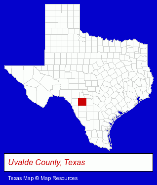
The Texas counties map at upper right shows Uvalde County, highlighted in red. Use the menu below to display interactive maps of Uvalde, either in a frame on this page or in full-screen mode.
Use the menu below to display categorized Uvalde directories.
| Uvalde Directory Page: | Clinics |
|---|
Selected Uvalde, Texas Listings
These Uvalde listings provide some insight into the city's cultural environment and economic climate.- Aircraft Parts & Equipment Retail
- Aircraft Painting, Service & Repair
- Newspaper Publishers
- Lawn & Garden Equipment & Supplies Retail
- Welding Services
- Welding Contractors
- Barbecue Equipment & Supplies Retail
- Barbecue Equipment Wholesale & Manufacturers
- Physicians & Surgeons
- Dentists
- Clinics & Medical Centers
- Clinics
- Internal Medicine Physicians & Surgeons
- Hunting
- Hunting Guides
- Climbing, Hiking & Backpacking
- Hunting Equipment & Supplies Dealers
- Private Hunting Facilities
- Printing Services
- Screen Printing
- Signs Wholesale & Manufacturers
- Wedding Supplies & Services
- Invitations & Announcements
- Moving & Storage
- Household Goods & Furniture Storage
- Household Goods Moving & Storage
- Lawn & Garden Equipment & Supplies Retail
- Consumer Electronics Stores
- Mattresses Retail
- Appliance Dealers
- Business Services
- Tourist Information & Attractions
- Chambers of Commerce
- Convention Visitors & Information Centers
Nearby Texas Cities and Towns *
- Bandera (1) - Bandera, Texas information and maps.
- Boerne (3) - Boerne, Texas information and maps.
- Fredericksburg (6) - Fredericksburg, Texas demographics and maps.
- Kerrville (9) - Kerrville, Texas demographics and directory.
- New Braunfels (25) - New Braunfels, Texas solutions directory and maps.
- Pleasanton (1) - Pleasanton, Texas information and maps.
- San Antonio (178) - San Antonio, Texas products & services directory.
* Parenthesized numbers indicate economic activity levels.
Copyright © 2011-2026 RegionalDirectory.us. All rights reserved.