Martinsville, Virginia Map and Directory
Regional Directory > States Menu > Virginia
 According to the United States Census Bureau, Martinsville is a City that is located in Martinsville City County, Virginia at 36.69 degrees North and 79.87 degrees West.
The city's time zone is America/New York, and the city's primary telephone area code is 276.
The land area of Martinsville is about 10.96 square miles, whereas the water area of the city is about 0.05 square miles.
Martinsville City County's land area is about 11 square miles, so the city occupies about 99.6 percent of the county's total land area.
According to the United States Census Bureau, Martinsville is a City that is located in Martinsville City County, Virginia at 36.69 degrees North and 79.87 degrees West.
The city's time zone is America/New York, and the city's primary telephone area code is 276.
The land area of Martinsville is about 10.96 square miles, whereas the water area of the city is about 0.05 square miles.
Martinsville City County's land area is about 11 square miles, so the city occupies about 99.6 percent of the county's total land area.
The Census Bureau estimates that Martinsville had about 12,554 residents in 2019, which is approximately 1,145 people per square mile of land area.
According to recent American Community Survey data, the median household income in Martinsville was about $34,371 per year.
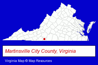
The Virginia counties map at upper right shows Martinsville City County, highlighted in red. Use the menu below to display interactive maps of Martinsville, either in a frame on this page or in full-screen mode.
Use the menu below to display categorized Martinsville directories.
| Martinsville Products and Services Directory | ||
|---|---|---|
| Building Materials | Home Improvement | Information Technology |
Selected Martinsville, Virginia Listings
These representative Martinsville listings provide some insight into the city's cultural environment and economic climate.- Insurance
- Auto Insurance
- Home Furnishings Stores
- Furniture Stores
- Furniture Wholesale & Manufacturers
- Attorneys
- Corporate Business Attorneys
- Estate Planning & Administration Attorneys
- Internet Products & Services
- Web Site Design
- Web Sites
- Auto Parts Retail
- Door & Window Dealers
- Auto Glass Retail
- Commercial & Industrial Building Materials & Supplies
- Physicians & Surgeons
- Dermatology Physicians & Surgeons
- Building & Home Construction
- Builders & Contractors
- Engineers
- Civil Engineers
- Structural Engineers
- Visual Arts
- Photography
- Professional Photographers
- Moving & Storage
- Household Goods & Furniture Storage
- Household Goods Moving & Storage
- Warehouses & Warehousing
- Wigs & Hairpieces Retail
- Health & Beauty Aids Retail
Nearby Virginia Cities and Towns *
- Blacksburg (4) - Blacksburg, Virginia information and maps.
- Charlottesville (28) - Charlottesville, Virginia solutions directory and maps.
- Danville (2) - Danville, Virginia information and maps.
- Lynchburg (11) - Lynchburg, Virginia demographics and directory.
- Roanoke (27) - Roanoke, Virginia solutions directory and maps.
- Salem (3) - Salem, Virginia information and maps.
* Parenthesized numbers indicate economic activity levels.
Copyright © 2011-2026 RegionalDirectory.us. All rights reserved.