Gillette, Wyoming Map and Directory
Regional Directory > States Menu > Wyoming
 According to the United States Census Bureau, Gillette is a City that is located in Campbell County, Wyoming at 44.29 degrees North and 105.50 degrees West.
The city's time zone is America/Denver, and the city's primary telephone area code is 307.
The land area of Gillette is about 20.85 square miles, whereas the water area of the city is about 0.03 square miles.
Campbell County's land area is about 4,803 square miles, so the city occupies about 0.4 percent of the county's total land area.
According to the United States Census Bureau, Gillette is a City that is located in Campbell County, Wyoming at 44.29 degrees North and 105.50 degrees West.
The city's time zone is America/Denver, and the city's primary telephone area code is 307.
The land area of Gillette is about 20.85 square miles, whereas the water area of the city is about 0.03 square miles.
Campbell County's land area is about 4,803 square miles, so the city occupies about 0.4 percent of the county's total land area.
The Census Bureau estimates that Gillette had about 32,030 residents in 2019, which is approximately 1,536 people per square mile of land area.
According to recent American Community Survey data, the median household income in Gillette was about $79,789 per year.
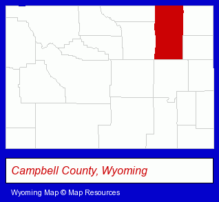
The Wyoming counties map at upper right shows Campbell County, highlighted in red. Use the menu below to display interactive maps of Gillette, either in a frame on this page or in full-screen mode.
Use the menu below to display categorized Gillette directories.
| Gillette Directory Page: | Schools |
|---|
Selected Gillette, Wyoming Listings
These Gillette listings provide some insight into the city's cultural environment and economic climate. Club Energize- Sports & Recreation Facilities
- Health Clubs & Gyms
- Tanning Salons
- Metals
- Welding Services
- Welding Contractors
- Auto Parts Retail
- Auto Parts Wholesale & Manufacturers
- Construction Machinery & Equipment Dealers
- Construction Machinery & Equipment Wholesale & Manufacturers
Nearby Wyoming Cities and Towns *
- Casper (14) - Casper, Wyoming demographics and directory.
- Cheyenne (11) - Cheyenne, Wyoming demographics and directory.
- Cody (6) - Cody, Wyoming demographics and maps.
- Dubois (2) - Dubois, Wyoming information and maps.
- Jackson (9) - Jackson, Wyoming demographics and directory.
- Laramie (5) - Laramie, Wyoming demographics and maps.
- Sheridan (1) - Sheridan, Wyoming information and maps.
* Parenthesized numbers indicate economic activity levels.
Copyright © 2011-2026 RegionalDirectory.us. All rights reserved.