Laramie, Wyoming Map and Directory
Regional Directory > States Menu > Wyoming
 According to the United States Census Bureau, Laramie is a City that is located in Albany County, Wyoming at 41.31 degrees North and 105.59 degrees West.
The city's time zone is America/Denver, and the city's primary telephone area code is 307.
The land area of Laramie is about 17.74 square miles, whereas the water area of the city is about 0.02 square miles.
Albany County's land area is about 4,274 square miles, so the city occupies about 0.4 percent of the county's total land area.
According to the United States Census Bureau, Laramie is a City that is located in Albany County, Wyoming at 41.31 degrees North and 105.59 degrees West.
The city's time zone is America/Denver, and the city's primary telephone area code is 307.
The land area of Laramie is about 17.74 square miles, whereas the water area of the city is about 0.02 square miles.
Albany County's land area is about 4,274 square miles, so the city occupies about 0.4 percent of the county's total land area.
The Census Bureau estimates that Laramie had about 32,711 residents in 2019, which is approximately 1,844 people per square mile of land area.
According to recent American Community Survey data, the median household income in Laramie was about $46,117 per year.
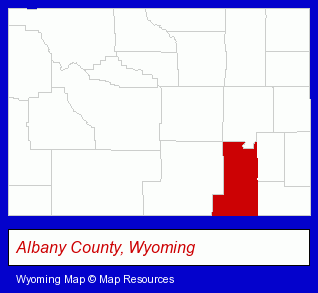
The Wyoming counties map at upper right shows Albany County, highlighted in red. Use the menu below to display interactive maps of Laramie, either in a frame on this page or in full-screen mode.
Use the menu below to display categorized Laramie directories.
| Laramie Products and Services Directory | ||
|---|---|---|
| Auto Service | Building Materials | Home Improvement |
| Physicians | Schools | |
Selected Laramie, Wyoming Listings
These randomly selected Laramie listings provide some insight into the city's cultural environment and economic climate.- Mortgages
- Credit Unions
- Public Schools
- Truck Dealers
- Used Cars
- Used Trucks
- Motorcycle, Motor Scooter & Minibike Dealers
- Used Motorcycles & Motor Scooters
- Metals
- Insurance
- Health Insurance
- Health Care Plans
- Airports
- Hotels
- Attorneys
- Corporate Business Attorneys
- Estate Planning & Administration Attorneys
- Civil Law Attorneys
- Administrative & Governmental Law Attorneys
- Industrial Equipment Rebuilding, Service & Repair
- Brake Service & Repair
- Auto Transmissions
- Auto Oil & Lube
- Libraries
- Institutional Libraries
- Elementary & Secondary Education
- Elementary Schools
- Private Schools
- Quilting Materials & Supplies Retail
- Cultural Attractions, Events & Facilities
- Tourist Information & Attractions
- Museums
- Arts Organizations & Information
- Sporting Goods Dealers
Nearby Wyoming Cities and Towns *
- Casper (14) - Casper, Wyoming demographics and directory.
- Cheyenne (11) - Cheyenne, Wyoming demographics and directory.
- Cody (6) - Cody, Wyoming demographics and maps.
- Gillette (1) - Gillette, Wyoming information and maps.
- Jackson (9) - Jackson, Wyoming demographics and directory.
- Sheridan (1) - Sheridan, Wyoming information and maps.
Large and Mid-size Cities in Nearby States
- Fort Collins, Colorado (42) - Fort Collins, CO solutions directory and maps.
* Parenthesized numbers indicate economic activity levels.
Copyright © 2011-2026 RegionalDirectory.us. All rights reserved.