Kapaa, Hawaii Map and Directory
Regional Directory > States Menu > Hawaii
 According to the United States Census Bureau, Kapaa is a Census-designated Place that is located in Kauai County, Hawaii at 22.09 degrees North and 159.35 degrees West.
The place's time zone is Pacific/Honolulu, and the place's primary telephone area code is 808.
The land area of Kapaa is about 10.03 square miles, whereas the water area of the place is about 0.33 square miles.
Kauai County's land area is about 620 square miles, so the place occupies about 1.6 percent of the county's total land area.
According to the United States Census Bureau, Kapaa is a Census-designated Place that is located in Kauai County, Hawaii at 22.09 degrees North and 159.35 degrees West.
The place's time zone is Pacific/Honolulu, and the place's primary telephone area code is 808.
The land area of Kapaa is about 10.03 square miles, whereas the water area of the place is about 0.33 square miles.
Kauai County's land area is about 620 square miles, so the place occupies about 1.6 percent of the county's total land area.
The Census Bureau estimates that Kapaa had about 10,580 residents in 2019, which is approximately 1,055 people per square mile of land area.
According to recent American Community Survey data, the median household income in Kapaa was about $90,925 per year.
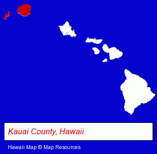
The Hawaii counties map at upper right shows Kauai County, highlighted in red. Use the menu below to display interactive maps of Kapaa, either in a frame on this page or in full-screen mode.
Use the menu below to display categorized Kapaa directories.
| Kapaa Directory Page: | Vacation Home Rental |
|---|
Selected Kapaa, Hawaii Listings
These Kapaa listings in zipcode 96746 provide a window into the place's cultural environment and economic climate. Kela's Glass Gallery- Visual Arts
- Art Galleries & Dealers
- Rental Stores & Yards
- Home Improvement & Maintenance
- Swimming Pool & Spa Construction & Contractors
- Spa & Hot Tub Dealers
- Public & Private Swimming Pools
Nearby Hawaii Cities and Towns *
- Honolulu (66) - Honolulu, Hawaii products & services directory.
- Lihue (1) - Lihue, Hawaii information and maps.
- Princeville (2) - Princeville, Hawaii information and maps.
* Parenthesized numbers indicate economic activity levels.
Copyright © 2011-2024 RegionalDirectory.us. All rights reserved.