El Dorado Hills, California Map and Directory
Regional Directory > States Menu > California
 According to the United States Census Bureau, El Dorado Hills is a Census-designated Place that is located in El Dorado County, California at 38.69 degrees North and 121.08 degrees West.
The place's time zone is America/Los Angeles, and the place's primary telephone area code is 916.
The land area of El Dorado Hills is about 48.45 square miles, whereas the water area of the place is about 0.16 square miles.
El Dorado County's land area is about 1,708 square miles, so the place occupies about 2.8 percent of the county's total land area.
According to the United States Census Bureau, El Dorado Hills is a Census-designated Place that is located in El Dorado County, California at 38.69 degrees North and 121.08 degrees West.
The place's time zone is America/Los Angeles, and the place's primary telephone area code is 916.
The land area of El Dorado Hills is about 48.45 square miles, whereas the water area of the place is about 0.16 square miles.
El Dorado County's land area is about 1,708 square miles, so the place occupies about 2.8 percent of the county's total land area.
The Census Bureau estimates that El Dorado Hills had about 46,593 residents in 2019, which is approximately 962 people per square mile of land area.
According to recent American Community Survey data, the median household income in El Dorado Hills was about $137,726 per year.
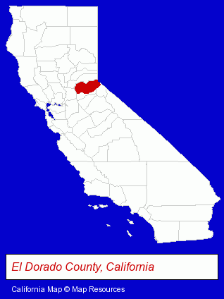
The California counties map at upper right shows El Dorado County, highlighted in red. Use the menu below to display interactive maps of El Dorado Hills, either in a frame on this page or in full-screen mode.
Use the menu below to display categorized El Dorado Hills directories.
| El Dorado Hills Products and Services Directory | |
|---|---|
| Business Services | Home Improvement |
Selected El Dorado Hills, California Listings
These representative El Dorado Hills listings provide some insight into the place's cultural environment and economic climate.- Security Systems & Services
- Alarm System Dealers
- Building & Home Construction
- Special Trades Contractors
- Electric Contractors
- Electric Contractors Residential
- Sports & Recreation Facilities
- Recreation Centers
- Sports & Recreation Clubs & Organizations
- Endodontics Dentists
- Loan & Financing Services
- Financial Counselors
- Auto Service & Repair
- Dentists
- Veterinarians
- Animal Hospitals
- Printing & Publishing
- Publishers
- Video Equipment, Parts & Supplies Retail
- Televisions Retail
- Big Screen Televisions Retail
- Industrial Equipment & Supplies Dealers
- Metals
- Security Systems & Services
- Clothing Wholesale & Manufacturers
- Safety Clothing & Equipment
- Schools
- Electric & Electronic Equipment & Supplies
- Consumer Electronics Stores
- Electric Equipment & Supplies Wholesale & Manufacturers
- Building & Home Construction
- Builders & Contractors
- Building Contractors
- Government Contractors
Nearby California Cities and Towns *
- Folsom (11) - Folsom, California demographics and directory.
- Loomis (3) - Loomis, California information and maps.
- Newcastle (1) - Newcastle, California information and maps.
- Orangevale (2) - Orangevale, California information and maps.
- Rocklin (11) - Rocklin, California demographics and directory.
- Roseville (30) - Roseville, California solutions directory and maps.
- Shingle Springs (1) - Shingle Springs, California information and maps.
* Parenthesized numbers indicate economic activity levels.
Copyright © 2011-2026 RegionalDirectory.us. All rights reserved.