Union City, California Map and Directory
Regional Directory > States Menu > California
 According to the United States Census Bureau, Union City is a City that is located in Alameda County, California at 37.60 degrees North and 122.02 degrees West.
The city's time zone is America/Los Angeles, and the city's primary telephone area code is 510.
The land area of Union City is about 19.40 square miles, whereas the water area of the city is about 0.00 square miles.
Alameda County's land area is about 739 square miles, so the city occupies about 2.6 percent of the county's total land area.
According to the United States Census Bureau, Union City is a City that is located in Alameda County, California at 37.60 degrees North and 122.02 degrees West.
The city's time zone is America/Los Angeles, and the city's primary telephone area code is 510.
The land area of Union City is about 19.40 square miles, whereas the water area of the city is about 0.00 square miles.
Alameda County's land area is about 739 square miles, so the city occupies about 2.6 percent of the county's total land area.
The Census Bureau estimates that Union City had about 74,107 residents in 2019, which is approximately 3,820 people per square mile of land area.
According to recent American Community Survey data, the median household income in Union City was about $114,681 per year.
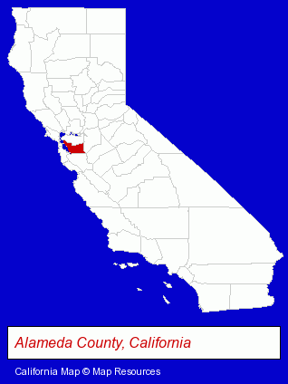
The California counties map at upper right shows Alameda County, highlighted in red. Use the menu below to display interactive maps of Union City, either in a frame on this page or in full-screen mode.
Use the menu below to display categorized Union City directories.
| Union City Directory Page: | Printing and Publishing |
|---|
Selected Union City, California Listings
These Union City listings provide some insight into the city's cultural environment and economic climate.- Building Materials & Supplies Wholesale & Manufacturers
- DUI and DWI Attorneys
- Immigration Law Attorneys
- Adoption Attorneys
- Printing Services
- Commercial Printing
- Copying & Duplicating Services
- Copying & Duplicating Services Commercial & Industrial
- Metals
- Metal Finishing
- Builders & Contractors
- Building Contractors
- Printing Services
- Commercial Printing
- Computer Printers
- Computer Supplies, Parts & Accessories
- Dentists
- Oral Surgeons
- Energy & Environment
- Solar Energy Systems & Services Retail
- Industrial Equipment & Supplies Wholesale & Manufacturers
- Exporters
- Industrial Equipment Parts & Accessories Wholesale & Manufacturers
- Plastic Molders
- Management Consultants
- Executive Coaching Consultants
- Building Contractors
- Mechanical Contractors
- Importers
- Medical Equipment & Supplies Retail
- Medical Equipment & Supplies Wholesale & Manufacturers
- Surgical Instruments Wholesale & Manufacturers
- Restaurants
- Steak Restaurants
- Caterers
- Beverages Retail
- Dentists
- Animal Hospitals
- Moving & Storage
- Industrial Equipment & Supplies Wholesale & Manufacturers
Nearby California Cities and Towns *
- Dublin (6) - Dublin, California demographics and maps.
- Fremont (29) - Fremont, California solutions directory and maps.
- Hayward (17) - Hayward, California solutions directory and maps.
- Palo Alto (20) - Palo Alto, California solutions directory and maps.
- Pleasanton (21) - Pleasanton, California solutions directory and maps.
- San Leandro (12) - San Leandro, California demographics and directory.
- San Ramon (13) - San Ramon, California demographics and directory.
* Parenthesized numbers indicate economic activity levels.
Copyright © 2011-2026 RegionalDirectory.us. All rights reserved.