Crested Butte, Colorado Map and Directory
Regional Directory > States Menu > Colorado
 According to the United States Census Bureau, Crested Butte is a Town that is located in Gunnison County, Colorado at 38.87 degrees North and 106.99 degrees West.
The town's time zone is America/Denver, and the town's primary telephone area code is 970.
The land area of Crested Butte is about 0.84 square miles, whereas the water area of the town is about 0.00 square miles.
Gunnison County's land area is about 3,239 square miles, so the town occupies about 0.0 percent of the county's total land area.
According to the United States Census Bureau, Crested Butte is a Town that is located in Gunnison County, Colorado at 38.87 degrees North and 106.99 degrees West.
The town's time zone is America/Denver, and the town's primary telephone area code is 970.
The land area of Crested Butte is about 0.84 square miles, whereas the water area of the town is about 0.00 square miles.
Gunnison County's land area is about 3,239 square miles, so the town occupies about 0.0 percent of the county's total land area.
The Census Bureau estimates that Crested Butte had about 1,541 residents in 2014, which is approximately 1,835 people per square mile of land area.
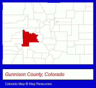
The Colorado counties map at upper right shows Gunnison County, highlighted in red. Use the menu below to display interactive maps of Crested Butte, either in a frame on this page or in full-screen mode.
Use the menu below to display categorized Crested Butte directories.
| Crested Butte Directory Page: | Sporting Goods Dealers |
|---|
Selected Crested Butte, Colorado Listings
These Crested Butte listings provide some insight into the town's cultural environment and economic climate.- Building & Home Construction
- Builders & Contractors
- Architectural Services
- Architects Residential
- Climbing, Hiking & Backpacking
- Mountain & Rock Climbing Equipment & Supplies
- Printing & Publishing
- Publishers
- Newspaper Publishers
- Building & Home Construction
- Engineers
- Architects
- Architectural Services
- Building Construction & Design Consultants
- Building & Home Construction
- Architects
- Architectural Services
- Building Construction & Design Consultants
- Information Technology Services
- Internet Products & Services
- Internet Services
- Internet Service Providers
- Lodging
- Hotels
- Hotel & Motel Reservations
- Property Management
- Real Estate Commercial & Industrial
- Property Maintenance
- Home Furnishings Stores
- Furniture Stores
- Building & Home Construction
- Architects
- Architectural Services
Nearby Colorado Cities and Towns *
- Aspen (9) - Aspen, Colorado demographics and directory.
- Avon (5) - Avon, Colorado demographics and maps.
- Carbondale (2) - Carbondale, Colorado information and maps.
- Glenwood Springs (3) - Glenwood Springs, Colorado information and maps.
- Gypsum (2) - Gypsum, Colorado information and maps.
* Parenthesized numbers indicate economic activity levels.
Copyright © 2011-2026 RegionalDirectory.us. All rights reserved.