Englewood, Colorado Map and Directory
Regional Directory > States Menu > Colorado
 According to the United States Census Bureau, Englewood is a City that is located in Arapahoe County, Colorado at 39.65 degrees North and 104.99 degrees West.
The city's time zone is America/Denver, and the city's primary telephone area code is 303.
The land area of Englewood is about 6.55 square miles, whereas the water area of the city is about 0.09 square miles.
Arapahoe County's land area is about 798 square miles, so the city occupies about 0.8 percent of the county's total land area.
According to the United States Census Bureau, Englewood is a City that is located in Arapahoe County, Colorado at 39.65 degrees North and 104.99 degrees West.
The city's time zone is America/Denver, and the city's primary telephone area code is 303.
The land area of Englewood is about 6.55 square miles, whereas the water area of the city is about 0.09 square miles.
Arapahoe County's land area is about 798 square miles, so the city occupies about 0.8 percent of the county's total land area.
The Census Bureau estimates that Englewood had about 34,917 residents in 2019, which is approximately 5,331 people per square mile of land area.
According to recent American Community Survey data, the median household income in Englewood was about $59,774 per year.
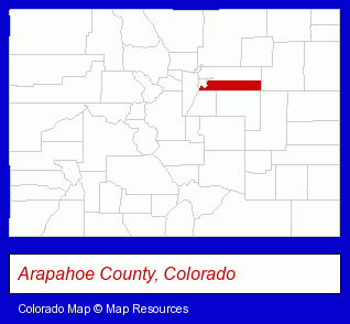
The Colorado counties map at upper right shows Arapahoe County, highlighted in red. Use the menu below to display interactive maps of Englewood, either in a frame on this page or in full-screen mode.
Use the menu below to display categorized Englewood directories.
Selected Englewood, Colorado Listings
These randomly selected Englewood listings provide some insight into the city's cultural environment and economic climate.- Auto Parts Retail
- Auto Parts Wholesale & Manufacturers
- Auto Transmissions
- Medical Equipment & Supplies Retail
- Ambulance Services
- Emergency Ambulance Services
- Air Ambulance Services
- Medical Equipment & Supplies Retail
- Dental Equipment & Supplies
- Office Furniture & Equipment Dealers
- Printing Equipment & Supplies Dealers
- Filing Equipment Systems & Supplies
- Hospitals
- Clothing & Accessories Retail
- Shoe Stores
- Ski Shops
- Ski Equipment Rental
- Boots & Safety Shoes Retail
- Lodging
- Hotels
- Motels
- Resorts & Vacation Cottages
- Hotel & Motel Management
- Speech & Hearing
- Hearing Aids & Assistive Devices Retail
- Speech & Hearing Equipment & Supplies Retail
- Financial Planning Consultants & Services
- Loan & Financing Services
- Financing Consultants
- Florists
- Floral & Balloon Arrangements
- Corporate Business Attorneys
- Bankruptcy Attorneys
- Civil Law Attorneys
- Industrial Equipment & Supplies Dealers
- Industrial Equipment & Supplies Wholesale & Manufacturers
- Pediatrics Dentists
- Personal Injury Attorneys
- Accident Attorneys
- Vehicular Accident Attorneys
- Outdoor Sports & Recreation
- Golf
- Golf Instruction
- Aircraft Parts & Equipment Retail
- Public Accountants
- Certified Public Accountants
- Estate Planning & Administration Attorneys
- Real Estate Attorneys
- Residential Real Estate Attorneys
- Property & Casualty Insurance
- Home Warranty Plans
Nearby Colorado Cities and Towns *
- Centennial (1) - Centennial, Colorado information and maps.
- Commerce City (6) - Commerce City, Colorado demographics and maps.
- Denver (144) - Denver, Colorado products & services directory.
- Golden (7) - Golden, Colorado demographics and maps.
- Lakewood (1) - Lakewood, Colorado information and maps.
- Littleton (30) - Littleton, Colorado solutions directory and maps.
- Wheat Ridge (3) - Wheat Ridge, Colorado information and maps.
Large and Mid-size Cities in Nearby States
- Cheyenne, Wyoming (11) - Cheyenne, WY demographics and maps.
- Laramie, Wyoming (5) - Laramie, WY information and maps.
* Parenthesized numbers indicate economic activity levels.
Copyright © 2011-2026 RegionalDirectory.us. All rights reserved.