Loveland, Colorado Map and Directory
Regional Directory > States Menu > Colorado
 According to the United States Census Bureau, Loveland is a City that is located in Larimer County, Colorado at 40.40 degrees North and 105.07 degrees West.
The city's time zone is America/Denver, and the city's primary telephone area code is 970.
The land area of Loveland is about 33.93 square miles, whereas the water area of the city is about 1.47 square miles.
Larimer County's land area is about 2,596 square miles, so the city occupies about 1.3 percent of the county's total land area.
According to the United States Census Bureau, Loveland is a City that is located in Larimer County, Colorado at 40.40 degrees North and 105.07 degrees West.
The city's time zone is America/Denver, and the city's primary telephone area code is 970.
The land area of Loveland is about 33.93 square miles, whereas the water area of the city is about 1.47 square miles.
Larimer County's land area is about 2,596 square miles, so the city occupies about 1.3 percent of the county's total land area.
The Census Bureau estimates that Loveland had about 78,877 residents in 2019, which is approximately 2,325 people per square mile of land area.
According to recent American Community Survey data, the median household income in Loveland was about $68,592 per year.
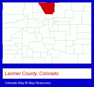
The Colorado counties map at upper right shows Larimer County, highlighted in red. Use the menu below to display interactive maps of Loveland, either in a frame on this page or in full-screen mode.
Use the menu below to display categorized Loveland directories.
| Loveland Products and Services Directory | ||
|---|---|---|
| Business Services | Chiropractors | Clinics |
| Home Improvement | Insurance | Physicians |
| Restaurants | Visual Arts | |
Selected Loveland, Colorado Listings
These randomly selected Loveland listings provide some insight into the city's cultural environment and economic climate.- Building Materials & Supplies Wholesale & Manufacturers
- Coffee & Tea Shops
- General Merchandise Wholesale
- Toy Stores
- Toys Wholesale & Manufacturers
- Dolls & Accessories Retail
- Toy Equipment & Supplies
- Industrial Equipment & Supplies Wholesale & Manufacturers
- Medical Equipment & Supplies Wholesale & Manufacturers
- Veterinary Equipment & Supplies
- Health Insurance
- Insurance Agents & Brokers
- Health Care Plans
- Importers
- Medical Equipment & Supplies Retail
- Veterinary Equipment & Supplies
- Tires Retail
- Crafts & Craft Supplies Retail
- Art Supplies Retail
- Engineers
- Electrical Engineers
- Funeral Services
- Funeral Homes & Directors
- Cemeteries & Memorial Parks
- Cemeteries & Crematories
- Cremation Services
Nearby Colorado Cities and Towns *
- Dacono (2) - Dacono, Colorado information and maps.
- Erie (1) - Erie, Colorado information and maps.
- Estes Park (6) - Estes Park, Colorado demographics and maps.
- Fort Collins (42) - Fort Collins, Colorado products & services directory.
- Greeley (10) - Greeley, Colorado demographics and directory.
- Longmont (19) - Longmont, Colorado solutions directory and maps.
- Windsor (1) - Windsor, Colorado information and maps.
Large and Mid-size Cities in Nearby States
- Cheyenne, Wyoming (11) - Cheyenne, WY demographics and maps.
- Laramie, Wyoming (5) - Laramie, WY information and maps.
* Parenthesized numbers indicate economic activity levels.
Copyright © 2011-2026 RegionalDirectory.us. All rights reserved.