Windsor, Colorado Map and Directory
Regional Directory > States Menu > Colorado
 According to the United States Census Bureau, Windsor is a Town that is located primarily in Weld County, Colorado at 40.48 degrees North and 104.92 degrees West.
The town's time zone is America/Denver, and the town's primary telephone area code is 970.
The land area of Windsor is about 24.43 square miles, whereas the water area of the town is about 0.32 square miles.
According to the United States Census Bureau, Windsor is a Town that is located primarily in Weld County, Colorado at 40.48 degrees North and 104.92 degrees West.
The town's time zone is America/Denver, and the town's primary telephone area code is 970.
The land area of Windsor is about 24.43 square miles, whereas the water area of the town is about 0.32 square miles.
The Census Bureau estimates that Windsor had about 30,477 residents in 2019, which is approximately 1,248 people per square mile of land area.
According to recent American Community Survey data, the median household income in Windsor was about $99,732 per year.
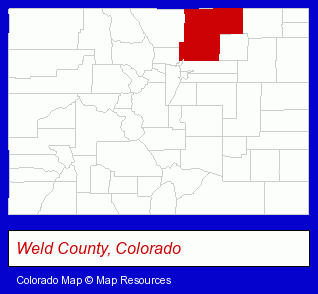
The Colorado counties map at upper right shows Weld County, highlighted in red. Use the menu below to display interactive maps of Windsor, either in a frame on this page or in full-screen mode.
Use the menu below to display categorized Windsor directories.
| Windsor Directory Page: | Home Improvement |
|---|
Selected Windsor, Colorado Listings
These Windsor listings in zipcode 80550 provide a window into the town's cultural environment and economic climate. Arapahoe Rentals- Event Planning
- Rental Stores & Yards
- Party Planning
- Fuels Retail
- Propane & Natural Gas
- Land Surveyors
- Surveyors
- Surveying Services
- Radio Stations
- Radio Sales & Service
- Auto Service & Repair
- Auto Customizing, Conversion & Restoration
- Building & Home Construction
- Plastering, Dry Wall & Insulation
- Insulation Contractors
- Auto Parts Wholesale & Manufacturers
- Truck Equipment, Parts & Accessories Retail
- Truck Parts & Equipment Wholesale & Manufacturers
- Engineers
- Building Materials & Supplies Wholesale & Manufacturers
- Engineering Services
- Waterjet Cutting Services
Nearby Colorado Cities and Towns *
- Dacono (2) - Dacono, Colorado information and maps.
- Erie (1) - Erie, Colorado information and maps.
- Fort Collins (42) - Fort Collins, Colorado products & services directory.
- Greeley (10) - Greeley, Colorado demographics and directory.
- Lafayette (6) - Lafayette, Colorado demographics and maps.
- Longmont (19) - Longmont, Colorado solutions directory and maps.
- Loveland (17) - Loveland, Colorado solutions directory and maps.
Large and Mid-size Cities in Nearby States
- Cheyenne, Wyoming (11) - Cheyenne, WY demographics and maps.
- Laramie, Wyoming (5) - Laramie, WY information and maps.
* Parenthesized numbers indicate economic activity levels.
Copyright © 2011-2026 RegionalDirectory.us. All rights reserved.