Parker, Colorado Map and Directory
Regional Directory > States Menu > Colorado
 According to the United States Census Bureau, Parker is a Town that is located in Douglas County, Colorado at 39.52 degrees North and 104.76 degrees West.
The town's time zone is America/Denver, and the town's primary telephone area code is 303.
The land area of Parker is about 21.29 square miles, whereas the water area of the town is about 0.01 square miles.
Douglas County's land area is about 840 square miles, so the town occupies about 2.5 percent of the county's total land area.
According to the United States Census Bureau, Parker is a Town that is located in Douglas County, Colorado at 39.52 degrees North and 104.76 degrees West.
The town's time zone is America/Denver, and the town's primary telephone area code is 303.
The land area of Parker is about 21.29 square miles, whereas the water area of the town is about 0.01 square miles.
Douglas County's land area is about 840 square miles, so the town occupies about 2.5 percent of the county's total land area.
The Census Bureau estimates that Parker had about 57,706 residents in 2019, which is approximately 2,710 people per square mile of land area.
According to recent American Community Survey data, the median household income in Parker was about $110,934 per year.
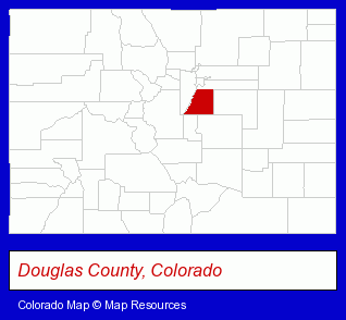
The Colorado counties map at upper right shows Douglas County, highlighted in red. Use the menu below to display interactive maps of Parker, either in a frame on this page or in full-screen mode.
Use the menu below to display categorized Parker directories.
| Parker Products and Services Directory | ||
|---|---|---|
| Dentists | Home Improvement | Landscape Contractors |
| Physicians | Schools | |
Selected Parker, Colorado Listings
These randomly selected Parker listings provide some insight into the town's cultural environment and economic climate.- Orthodontics Dentists
- Pet Care Services
- Pet Grooming & Boarding
- Pet Grooming
- Visual Arts
- Quilting Materials & Supplies Retail
- Cleaning Services
- Osteopathic Physicians & Surgeons
- Pediatrics Physicians & Surgeons
- Funeral Services
- Funeral Homes & Directors
- Cemeteries & Memorial Parks
- Cemeteries & Crematories
- Cremation Services
- Landscape Services
- Lawn & Garden Equipment & Supplies Retail
- Water Gardens, Fountains & Ponds
- Lawn & Garden Furnishings
- Lawn & Garden Services
- Lawn Services
- Lawn Installation & Maintenance Services
- American Restaurants
Nearby Colorado Cities and Towns *
- Aurora (24) - Aurora, Colorado solutions directory and maps.
- Castle Rock (8) - Castle Rock, Colorado demographics and maps.
- Centennial (1) - Centennial, Colorado information and maps.
- Denver (144) - Denver, Colorado products & services directory.
- Englewood (33) - Englewood, Colorado products & services directory.
- Littleton (30) - Littleton, Colorado solutions directory and maps.
Large and Mid-size Cities in Nearby States
- Cheyenne, Wyoming (11) - Cheyenne, WY demographics and maps.
* Parenthesized numbers indicate economic activity levels.
Copyright © 2011-2026 RegionalDirectory.us. All rights reserved.