Aurora, Colorado Map and Directory
Regional Directory > States Menu > Colorado
 According to the United States Census Bureau, Aurora is a City that is located primarily in Adams County, Colorado at 39.69 degrees North and 104.69 degrees West.
The city's time zone is America/Denver, and the city's primary telephone area code is 303.
The land area of Aurora is about 153.52 square miles, whereas the water area of the city is about 0.67 square miles.
According to the United States Census Bureau, Aurora is a City that is located primarily in Adams County, Colorado at 39.69 degrees North and 104.69 degrees West.
The city's time zone is America/Denver, and the city's primary telephone area code is 303.
The land area of Aurora is about 153.52 square miles, whereas the water area of the city is about 0.67 square miles.
The Census Bureau estimates that Aurora had about 379,289 residents in 2019, which is approximately 2,471 people per square mile of land area.
According to recent American Community Survey data, the median household income in Aurora was about $65,100 per year.
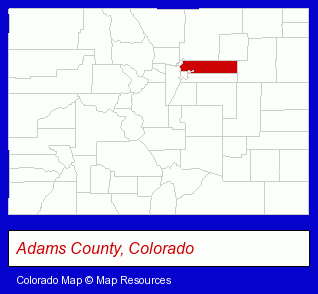
The Colorado counties map at upper right shows Adams County, highlighted in red. Use the menu below to display interactive maps of Aurora, either in a frame on this page or in full-screen mode.
Use the menu below to display categorized Aurora directories.
Selected Aurora, Colorado Listings
These randomly selected Aurora listings in 80014 provide a window into the city's cultural environment and economic climate. Advantage Security Inc- Security Systems & Services
- Investigation Services
- Security Consultants & Agencies
- Home Health Care
- Nurses
- Alternative Medicine
- Chiropractors
- Alternative Medicine Practitioners
- Property Management
- Property Maintenance
- Osteopathic Physicians & Surgeons
- Family & General Practice Physicians & Surgeons
- Party Equipment & Supplies Sales & Rental
- Masquerade & Theatrical Costumes Sales & Rental
- Costume Sales & Rental
- Cleaning Services
- Pet Food & Supplies Retail
- Pet Shops
- Aquariums & Supplies Retail
- Dog & Cat Supplies & Services
- Pet Grooming Supplies
- Accountants
- Public Accountants
- Certified Public Accountants
- Freight & Cargo Transport
- Freight Forwarding
- Property Management
- Real Estate Commercial & Industrial
- Real Estate Investments
- Hair Care & Treatment
- Skin Care Products
- Hair Removal
Nearby Colorado Cities and Towns *
- Brighton (3) - Brighton, Colorado information and maps.
- Commerce City (6) - Commerce City, Colorado demographics and maps.
- Denver (144) - Denver, Colorado products & services directory.
- Englewood (33) - Englewood, Colorado products & services directory.
- Littleton (30) - Littleton, Colorado solutions directory and maps.
- Parker (5) - Parker, Colorado demographics and maps.
- Wheat Ridge (3) - Wheat Ridge, Colorado information and maps.
Large and Mid-size Cities in Nearby States
- Cheyenne, Wyoming (11) - Cheyenne, WY demographics and maps.
* Parenthesized numbers indicate economic activity levels.
Copyright © 2011-2026 RegionalDirectory.us. All rights reserved.