Steamboat Springs, Colorado Map and Directory
Regional Directory > States Menu > Colorado
 According to the United States Census Bureau, Steamboat Springs is a City that is located in Routt County, Colorado at 40.48 degrees North and 106.83 degrees West.
The city's time zone is America/Denver, and the city's primary telephone area code is 970.
The land area of Steamboat Springs is about 10.15 square miles, whereas the water area of the city is about 0.01 square miles.
Routt County's land area is about 2,362 square miles, so the city occupies about 0.4 percent of the county's total land area.
According to the United States Census Bureau, Steamboat Springs is a City that is located in Routt County, Colorado at 40.48 degrees North and 106.83 degrees West.
The city's time zone is America/Denver, and the city's primary telephone area code is 970.
The land area of Steamboat Springs is about 10.15 square miles, whereas the water area of the city is about 0.01 square miles.
Routt County's land area is about 2,362 square miles, so the city occupies about 0.4 percent of the county's total land area.
The Census Bureau estimates that Steamboat Springs had about 13,214 residents in 2019, which is approximately 1,302 people per square mile of land area.
According to recent American Community Survey data, the median household income in Steamboat Springs was about $77,419 per year.
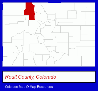
The Colorado counties map at upper right shows Routt County, highlighted in red. Use the menu below to display interactive maps of Steamboat Springs, either in a frame on this page or in full-screen mode.
Use the menu below to display categorized Steamboat Springs directories.
| Steamboat Springs Products and Services Directory | ||
|---|---|---|
| Architects | Building Materials | Business Services |
| Home Improvement | Hotels | Restaurants |
| Sporting Goods Dealers | Visual Arts | |
Selected Steamboat Springs, Colorado Listings
These randomly selected Steamboat Springs listings provide some insight into the city's cultural environment and economic climate.- Attorneys
- Corporate Business Attorneys
- Personal Injury Attorneys
- Employment & Labor Law Attorneys
- Security Systems & Services
- Investigation Services
- Driver Training
- Security Consultants & Agencies
- Defensive Driving Instruction
- Exercise & Fitness Classes & Instruction
- Gymnastics Instruction
- Dentists
- Building & Home Construction
- Architects
- Architectural Services
- Arts Organizations & Information
- Art Schools
- Clothing Stores
- Office Supplies Retail
- Clothing & Accessories Retail
- Stationery Retail
- Property Management
- Property Maintenance
- Dentists
- Travel Agents
- Travel Industry
- Air Transportation
- Airline Tickets
- Steak Restaurants
- American Restaurants
- Bar & Grill Restaurants
- Building & Home Construction
- Architects
- Architectural Services
Nearby Colorado Cities and Towns *
- Avon (5) - Avon, Colorado demographics and maps.
- Boulder (60) - Boulder, Colorado products & services directory.
- Edwards (2) - Edwards, Colorado information and maps.
- Glenwood Springs (3) - Glenwood Springs, Colorado information and maps.
- Grand Lake (2) - Grand Lake, Colorado information and maps.
- Gypsum (2) - Gypsum, Colorado information and maps.
- Vail (4) - Vail, Colorado information and maps.
* Parenthesized numbers indicate economic activity levels.
Copyright © 2011-2026 RegionalDirectory.us. All rights reserved.