New Milford, Connecticut Map and Directory
Regional Directory > States Menu > Connecticut
 According to the United States Census Bureau, New Milford is a Town that is located in Litchfield County, Connecticut at 41.60 degrees North and 73.42 degrees West.
The town's time zone is America/New York, and the town's primary telephone area code is 959.
The land area of New Milford is about 61.57 square miles, whereas the water area of the town is about 2.16 square miles.
Litchfield County's land area is about 921 square miles, so the town occupies about 6.7 percent of the county's total land area.
According to the United States Census Bureau, New Milford is a Town that is located in Litchfield County, Connecticut at 41.60 degrees North and 73.42 degrees West.
The town's time zone is America/New York, and the town's primary telephone area code is 959.
The land area of New Milford is about 61.57 square miles, whereas the water area of the town is about 2.16 square miles.
Litchfield County's land area is about 921 square miles, so the town occupies about 6.7 percent of the county's total land area.
The Census Bureau estimates that New Milford had about 27,014 residents in 2019, which is approximately 439 people per square mile of land area.
According to recent American Community Survey data, the median household income in New Milford was about $89,969 per year.
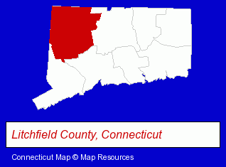
The Connecticut counties map at upper right shows Litchfield County, highlighted in red. Use the menu below to display interactive maps of New Milford, either in a frame on this page or in full-screen mode.
Use the menu below to display categorized New Milford directories.
| New Milford Products and Services Directory | ||
|---|---|---|
| Building Materials | Home Improvement | Landscape Contractors |
| Masonry Contractors | ||
Selected New Milford, Connecticut Listings
These randomly selected New Milford listings provide some insight into the town's cultural environment and economic climate.- Industrial Equipment & Supplies Dealers
- Industrial Equipment & Supplies Wholesale & Manufacturers
- Importers
- Woodworking Equipment & Supplies
- Accountants
- Public Accountants
- Certified Public Accountants
- Tax Return Preparation Accountants
- Cosmetics Retail
- Building & Home Construction
- Heating & Air Conditioning Contractors
- Air Duct Cleaning
- Restaurants
- Steak Restaurants
- American Restaurants
- Clothing Stores
- Electronic Equipment & Supplies Wholesale & Manufacturers
- Electronic Equipment & Supplies Retail
- Visual Arts
- Art Galleries & Dealers
- Chemicals Wholesale & Manufacturers
- Carpet & Rug Dealers
- Building Materials & Supplies Wholesale & Manufacturers
- Office Building & Industrial Cleaning Services
- Janitorial Services
- Interior Building Cleaning
- HVAC Equipment & Supplies Dealers
- Heating Equipment & Systems Dealers
- Medical Equipment & Supplies Retail
- Laboratories
- Testing Laboratories
- Optical Goods Wholesalers & Manufacturers
- Analytical Testing Laboratories
Nearby Connecticut Cities and Towns *
- Bethel (7) - Bethel, Connecticut demographics and maps.
- Brookfield (2) - Brookfield, Connecticut information and maps.
- Danbury (17) - Danbury, Connecticut solutions directory and maps.
- Litchfield (2) - Litchfield, Connecticut information and maps.
- Newtown (3) - Newtown, Connecticut information and maps.
- Southbury (2) - Southbury, Connecticut information and maps.
- Woodbury (4) - Woodbury, Connecticut information and maps.
* Parenthesized numbers indicate economic activity levels.
Copyright © 2011-2026 RegionalDirectory.us. All rights reserved.