Lewes, Delaware Map and Directory
Regional Directory > States Menu > Delaware
 According to the United States Census Bureau, Lewes is a City that is located in Sussex County, Delaware at 38.77 degrees North and 75.14 degrees West.
The city's time zone is America/New York, and the city's primary telephone area code is 302.
The land area of Lewes is about 3.80 square miles, whereas the water area of the city is about 0.92 square miles.
Sussex County's land area is about 936 square miles, so the city occupies about 0.4 percent of the county's total land area.
According to the United States Census Bureau, Lewes is a City that is located in Sussex County, Delaware at 38.77 degrees North and 75.14 degrees West.
The city's time zone is America/New York, and the city's primary telephone area code is 302.
The land area of Lewes is about 3.80 square miles, whereas the water area of the city is about 0.92 square miles.
Sussex County's land area is about 936 square miles, so the city occupies about 0.4 percent of the county's total land area.
The Census Bureau estimates that Lewes had about 2,943 residents in 2014, which is approximately 774 people per square mile of land area.
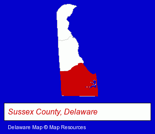
The Delaware counties map at upper right shows Sussex County, highlighted in red. Use the menu below to display interactive maps of Lewes, either in a frame on this page or in full-screen mode.
Use the menu below to display categorized Lewes directories.
| Lewes Products and Services Directory | |
|---|---|
| Home Furnishings | Physicians |
Selected Lewes, Delaware Listings
These representative Lewes listings provide some insight into the city's cultural environment and economic climate.- Sporting Goods Dealers
- Fishing Equipment & Supplies Dealers
- Fishing Bait & Tackle
- Fishing Guides & Charters
- Hunting Guides
- Information Technology Services
- Computer Consultants
- Computer Systems Consultants & Designers
- Furniture Stores
- Unfinished Furniture
- Attorneys
- Business Services
- Business Management Services
- Corporate Business Attorneys
- Building & Home Construction
- Special Trades Contractors
- Electric Contractors
- Lodging
- Hotels
- Building & Home Construction
- Builders & Contractors
- Roofing Contractors
- Roofing
- Alternative Medicine
- Chiropractors
- Alternative Medicine Practitioners
- Laboratories
- Research & Development Laboratories
- Tours & Charters
- Boat & Yacht Charters, Rental & Leasing
- Fishing Guides & Charters
- Fishing Boat Charters, Tours & Rental
- Fishing Expeditions
- Radio Stations
- Educational Consultants
Nearby Delaware Cities and Towns *
- Dover (5) - Dover, Delaware demographics and maps.
- Fenwick Island (1) - Fenwick Island, Delaware information and maps.
- Milford (1) - Milford, Delaware information and maps.
- Newark (15) - Newark, Delaware demographics and directory.
- Rehoboth Beach (4) - Rehoboth Beach, Delaware information and maps.
- Wilmington (30) - Wilmington, Delaware solutions directory and maps.
Large and Mid-size Cities in Nearby States
- Cape May, New Jersey (5) - Cape May, NJ information and maps.
* Parenthesized numbers indicate economic activity levels.
Copyright © 2011-2026 RegionalDirectory.us. All rights reserved.