Jacksonville, Florida Map and Directory
Regional Directory > States Menu > Florida
 According to the United States Census Bureau, Jacksonville is a City that is located in Duval County, Florida at 30.33 degrees North and 81.66 degrees West.
The city's time zone is America/New York, and the city's primary telephone area code is 904.
The land area of Jacksonville is about 747.44 square miles, whereas the water area of the city is about 127.19 square miles.
Duval County's land area is about 762 square miles, so the city occupies about 98.1 percent of the county's total land area.
According to the United States Census Bureau, Jacksonville is a City that is located in Duval County, Florida at 30.33 degrees North and 81.66 degrees West.
The city's time zone is America/New York, and the city's primary telephone area code is 904.
The land area of Jacksonville is about 747.44 square miles, whereas the water area of the city is about 127.19 square miles.
Duval County's land area is about 762 square miles, so the city occupies about 98.1 percent of the county's total land area.
The Census Bureau estimates that Jacksonville had about 911,507 residents in 2019, which is approximately 1,220 people per square mile of land area.
According to recent American Community Survey data, the median household income in Jacksonville was about $54,701 per year. This Jacksonville Real Estate directory lists real estate solution providers in Jacksonville, Florida.
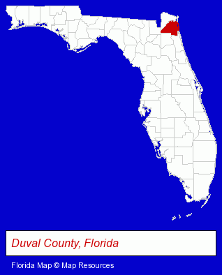
The Florida counties map at upper right shows Duval County, highlighted in red. Use the menu below to display interactive maps of Jacksonville, either in a frame on this page or in full-screen mode.
Use the menu below to display categorized Jacksonville directories.
Selected Jacksonville, Florida Listings
These randomly selected Jacksonville listings provide some insight into the city's cultural environment and economic climate.- Sportswear Retail
- Orthopedic Shoes Retail
- Prosthetic & Artificial Limbs
- Orthopedic Appliances Retail
- Business Consultants & Advisors
- Management Consultants
- Business Management Services
- Marketing Consultants
- Machine Shops
- CNC Machining, Turning & Milling Shops
- Plastic & Plastic Products Wholesale & Manufacturers
- Used Cars
- Used Trucks
- Sports & Recreation Facilities
- Health Clubs & Gyms
- Exercise & Fitness Classes & Instruction
- Fitness Consultants
- Personal Trainers
- Household Goods & Furniture Storage
- Household Goods Moving & Storage
- Commodity & Merchandise Warehouses
- Oil & Gas Companies
- Nurseries
- Plastic & Plastic Products Wholesale & Manufacturers
- Toy Stores
- Collectible Doll Dealers
- Business Consultants & Advisors
- Management Consultants
- Business Management Services
- Lawn & Garden Outdoor Power Equipment
- Lawn Mowers Retail
- Property & Casualty Insurance
- Insurance Agents & Brokers
- Pet Food & Supplies Retail
- Pet Shops
- Building & Home Construction
- Special Trades Contractors
- Electric Contractors Residential
- Public Accountants
- Certified Public Accountants
- Criminal Law Attorneys
- Appeals Attorneys
- Preventive Medicine Veterinarians
- Internal Medicine Veterinarians
Nearby Florida Cities and Towns *
- Daytona Beach (25) - Daytona Beach, Florida solutions directory and maps.
- Fernandina Beach (4) - Fernandina Beach, Florida information and maps.
- Gainesville (31) - Gainesville, Florida solutions directory and maps.
- Jacksonville Beach (1) - Jacksonville Beach, Florida information and maps.
- Ocala (18) - Ocala, Florida solutions directory and maps.
- Orange Park (8) - Orange Park, Florida demographics and maps.
- Saint Augustine (13) - Saint Augustine, Florida demographics and directory.
* Parenthesized numbers indicate economic activity levels.
Copyright © 2011-2026 RegionalDirectory.us. All rights reserved.