Thomasville, Georgia Map and Directory
Regional Directory > States Menu > Georgia
 According to the United States Census Bureau, Thomasville is a City that is located in Thomas County, Georgia at 30.84 degrees North and 83.98 degrees West.
The city's time zone is America/New York, and the city's primary telephone area code is 229.
The land area of Thomasville is about 15.01 square miles, whereas the water area of the city is about 0.13 square miles.
Thomas County's land area is about 545 square miles, so the city occupies about 2.8 percent of the county's total land area.
According to the United States Census Bureau, Thomasville is a City that is located in Thomas County, Georgia at 30.84 degrees North and 83.98 degrees West.
The city's time zone is America/New York, and the city's primary telephone area code is 229.
The land area of Thomasville is about 15.01 square miles, whereas the water area of the city is about 0.13 square miles.
Thomas County's land area is about 545 square miles, so the city occupies about 2.8 percent of the county's total land area.
The Census Bureau estimates that Thomasville had about 18,518 residents in 2019, which is approximately 1,234 people per square mile of land area.
According to recent American Community Survey data, the median household income in Thomasville was about $32,378 per year.
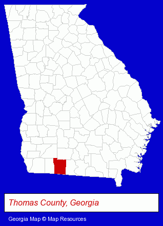
The Georgia counties map at upper right shows Thomas County, highlighted in red. Use the menu below to display interactive maps of Thomasville, either in a frame on this page or in full-screen mode.
Use the menu below to display categorized Thomasville directories.
| Thomasville Products and Services Directory | ||
|---|---|---|
| Auto Service | Dentists | Insurance |
| Schools | ||
Selected Thomasville, Georgia Listings
These randomly selected Thomasville listings provide some insight into the city's cultural environment and economic climate.- Used & Rebuilt Auto Parts Retail
- Exporters
- Plastic & Plastic Products Wholesale & Manufacturers
- Advertising
- Display Designers & Producers
- Advertising Displays
- Alternative Medicine
- Beauty & Day Spas
- Fasteners
- Industrial Equipment Rebuilding, Service & Repair
- Electric & Electronic Equipment & Supplies
- Electric Motor Dealers
- Pump Service & Repair
- Swimming Pool Dealers
- Swimming Pool Equipment & Supplies Dealers
- Elementary & Secondary Education
- Elementary Schools
- Preschools & Kindergartens
- Private Schools
Nearby Georgia Cities and Towns *
- Albany (7) - Albany, Georgia demographics and maps.
- Columbus (18) - Columbus, Georgia solutions directory and maps.
- Macon (15) - Macon, Georgia demographics and directory.
- Moultrie (3) - Moultrie, Georgia information and maps.
- Tifton (1) - Tifton, Georgia information and maps.
- Valdosta (8) - Valdosta, Georgia demographics and maps.
Large and Mid-size Cities in Nearby States
- Tallahassee, Florida (38) - Tallahassee, FL solutions directory and maps.
* Parenthesized numbers indicate economic activity levels.
Copyright © 2011-2026 RegionalDirectory.us. All rights reserved.