Valdosta, Georgia Map and Directory
Regional Directory > States Menu > Georgia
 According to the United States Census Bureau, Valdosta is a City that is located in Lowndes County, Georgia at 30.83 degrees North and 83.28 degrees West.
The city's time zone is America/New York, and the city's primary telephone area code is 229.
The land area of Valdosta is about 35.86 square miles, whereas the water area of the city is about 0.52 square miles.
Lowndes County's land area is about 496 square miles, so the city occupies about 7.2 percent of the county's total land area.
According to the United States Census Bureau, Valdosta is a City that is located in Lowndes County, Georgia at 30.83 degrees North and 83.28 degrees West.
The city's time zone is America/New York, and the city's primary telephone area code is 229.
The land area of Valdosta is about 35.86 square miles, whereas the water area of the city is about 0.52 square miles.
Lowndes County's land area is about 496 square miles, so the city occupies about 7.2 percent of the county's total land area.
The Census Bureau estimates that Valdosta had about 56,457 residents in 2019, which is approximately 1,574 people per square mile of land area.
According to recent American Community Survey data, the median household income in Valdosta was about $32,595 per year.
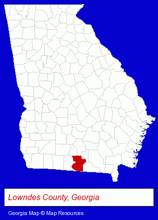
The Georgia counties map at upper right shows Lowndes County, highlighted in red. Use the menu below to display interactive maps of Valdosta, either in a frame on this page or in full-screen mode.
Use the menu below to display categorized Valdosta directories.
| Valdosta Products and Services Directory | ||
|---|---|---|
| Accountants | Attorneys | Business Services |
| Financial Services | Insurance | Personal Injury Attorneys |
| Physicians | Printing and Publishing | |
Selected Valdosta, Georgia Listings
These randomly selected Valdosta listings provide some insight into the city's cultural environment and economic climate.- Chemicals Wholesale & Manufacturers
- Restaurants
- Steak Restaurants
- Caterers
- Building & Home Construction
- Business & Professional Associations & Organizations
- Architects
- Architectural Services
- Public Accountants
- Accounting, Auditing & Bookkeeping Services
- Certified Public Accountants
- Truck Dealers
- Used Cars
- Used Trucks
- Business Consultants & Advisors
- Advertising
- Advertising Agencies & Consultants
- Advertising & Design Agencies
- Criminal Law Attorneys
- Family Law Attorneys
- Employment & Labor Law Attorneys
- Land Surveyors
- Surveyors
- Surveying Services
- Land Surveyors Commercial
- Beauty Salons
- Hair Care & Treatment
- Barbers
- Beauticians
- Sports & Recreation Clubs & Organizations
- Country Clubs
- Podiatry Physicians & Surgeons
Nearby Georgia Cities and Towns *
- Albany (7) - Albany, Georgia demographics and maps.
- Columbus (18) - Columbus, Georgia solutions directory and maps.
- Douglas (1) - Douglas, Georgia information and maps.
- Macon (15) - Macon, Georgia demographics and directory.
- Moultrie (3) - Moultrie, Georgia information and maps.
- Thomasville (4) - Thomasville, Georgia information and maps.
- Tifton (1) - Tifton, Georgia information and maps.
* Parenthesized numbers indicate economic activity levels.
Copyright © 2011-2026 RegionalDirectory.us. All rights reserved.