Cedar Falls, Iowa Map and Directory
Regional Directory > States Menu > Iowa
 According to the United States Census Bureau, Cedar Falls is a City that is located in Black Hawk County, Iowa at 42.53 degrees North and 92.45 degrees West.
The city's time zone is America/Chicago, and the city's primary telephone area code is 319.
The land area of Cedar Falls is about 28.75 square miles, whereas the water area of the city is about 0.85 square miles.
Black Hawk County's land area is about 566 square miles, so the city occupies about 5.1 percent of the county's total land area.
According to the United States Census Bureau, Cedar Falls is a City that is located in Black Hawk County, Iowa at 42.53 degrees North and 92.45 degrees West.
The city's time zone is America/Chicago, and the city's primary telephone area code is 319.
The land area of Cedar Falls is about 28.75 square miles, whereas the water area of the city is about 0.85 square miles.
Black Hawk County's land area is about 566 square miles, so the city occupies about 5.1 percent of the county's total land area.
The Census Bureau estimates that Cedar Falls had about 40,536 residents in 2019, which is approximately 1,410 people per square mile of land area.
According to recent American Community Survey data, the median household income in Cedar Falls was about $61,420 per year.
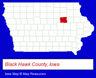
The Iowa counties map at upper right shows Black Hawk County, highlighted in red. Use the menu below to display interactive maps of Cedar Falls, either in a frame on this page or in full-screen mode.
Use the menu below to display categorized Cedar Falls directories.
| Cedar Falls Products and Services Directory | ||
|---|---|---|
| Clothing Stores | Home Improvement | Information Technology |
| Pizza Restaurants | Printing and Publishing | Restaurants |
| Sporting Goods Dealers | ||
Selected Cedar Falls, Iowa Listings
These randomly selected Cedar Falls listings provide some insight into the city's cultural environment and economic climate.- Industrial Equipment & Supplies Wholesale & Manufacturers
- Industrial Equipment Parts & Accessories Wholesale & Manufacturers
- Funeral Services
- Monuments & Markers Dealers
- Italian Restaurants
- Property Management
- Shopping Centers & Malls
- Department Stores
- Building & Home Construction
- Plumbing Contractors
- Heating Contractors
- Heating & Air Conditioning Contractors
- Bicycle Dealers
- Bicycle Repair & Maintenance
- Bicycle Rental
- Ski Shops
- Ski Equipment Rental
- Publishers
- Newsletter & Small Publication Production Services
- Metals
- Sporting Goods Dealers
- Metal Stamping Equipment & Supplies
- Banks
- Steak Restaurants
- Thai Restaurants
- Bar & Grill Restaurants
- Bars & Pubs
- Pubs
- Printing Services
- Commercial Printing
- Copying & Duplicating Services
- Desktop Publishing
- RVs Wholesale & Manufacturers
- Housewares Stores
- Audiovisual Equipment Service & Repair
- Vacuum Cleaning Systems
- Building & Home Construction
- Special Trades Contractors
- Electric Contractors
- Electric Contractors Residential
- Building Construction & Design Consultants
Nearby Iowa Cities and Towns *
- Cedar Rapids (19) - Cedar Rapids, Iowa solutions directory and maps.
- Des Moines (28) - Des Moines, Iowa solutions directory and maps.
- Marshalltown (2) - Marshalltown, Iowa information and maps.
- Vinton (1) - Vinton, Iowa information and maps.
- Waterloo (6) - Waterloo, Iowa demographics and maps.
* Parenthesized numbers indicate economic activity levels.
Copyright © 2011-2026 RegionalDirectory.us. All rights reserved.