Waterloo, Iowa Map and Directory
Regional Directory > States Menu > Iowa
 According to the United States Census Bureau, Waterloo is a City that is located in Black Hawk County, Iowa at 42.49 degrees North and 92.34 degrees West.
The city's time zone is America/Chicago, and the city's primary telephone area code is 319.
The land area of Waterloo is about 61.39 square miles, whereas the water area of the city is about 1.84 square miles.
Black Hawk County's land area is about 566 square miles, so the city occupies about 10.8 percent of the county's total land area.
According to the United States Census Bureau, Waterloo is a City that is located in Black Hawk County, Iowa at 42.49 degrees North and 92.34 degrees West.
The city's time zone is America/Chicago, and the city's primary telephone area code is 319.
The land area of Waterloo is about 61.39 square miles, whereas the water area of the city is about 1.84 square miles.
Black Hawk County's land area is about 566 square miles, so the city occupies about 10.8 percent of the county's total land area.
The Census Bureau estimates that Waterloo had about 67,328 residents in 2019, which is approximately 1,097 people per square mile of land area.
According to recent American Community Survey data, the median household income in Waterloo was about $47,327 per year.
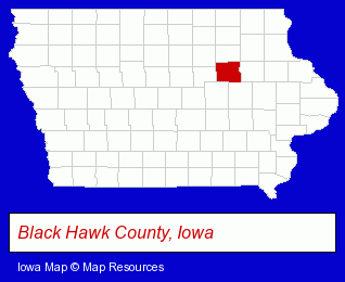
The Iowa counties map at upper right shows Black Hawk County, highlighted in red. Use the menu below to display interactive maps of Waterloo, either in a frame on this page or in full-screen mode.
Use the menu below to display categorized Waterloo directories.
| Waterloo Products and Services Directory | ||
|---|---|---|
| Business Services | Financial Services | Home Improvement |
| Physicians | Printing and Publishing | Restaurants |
Selected Waterloo, Iowa Listings
These randomly selected Waterloo listings provide some insight into the city's cultural environment and economic climate.- Food Products Wholesale & Manufacturers
- Meats Retail
- Meats Wholesale
- Meats
- Meat Processing
- Italian Restaurants
- Corporate Business Attorneys
- Estate Planning & Administration Attorneys
- Real Estate Attorneys
- Social & Human Services
- Clinics & Medical Centers
- Medical Services
- Home Health Care
- Hospice Services
- Building & Home Construction
- Builders & Contractors
- Building Remodeling & Repair Contractors
- Concrete Contractors
- Lawn & Garden Equipment & Supplies Retail
- Steak Restaurants
- Pet Care Services
- Pet Training
- Golf
- Golf Courses
- Miniature Golf Courses
- Visual Arts
- Photography
- Photofinishing Retail
- Bus Travel
- Medical Equipment & Supplies Retail
- Agricultural Equipment & Supplies Retail
- Farm Equipment & Supplies Dealers
Nearby Iowa Cities and Towns *
- Cedar Falls (7) - Cedar Falls, Iowa demographics and maps.
- Cedar Rapids (19) - Cedar Rapids, Iowa solutions directory and maps.
- Iowa City (8) - Iowa City, Iowa demographics and maps.
- Marion (1) - Marion, Iowa information and maps.
- Marshalltown (2) - Marshalltown, Iowa information and maps.
- Vinton (1) - Vinton, Iowa information and maps.
* Parenthesized numbers indicate economic activity levels.
Copyright © 2011-2026 RegionalDirectory.us. All rights reserved.