Anderson, Indiana Map and Directory
Regional Directory > States Menu > Indiana
 According to the United States Census Bureau, Anderson is a City that is located in Madison County, Indiana at 40.11 degrees North and 85.68 degrees West.
The city's time zone is America/Indiana/Indianapolis, and the city's primary telephone area code is 765.
The land area of Anderson is about 42.57 square miles, whereas the water area of the city is about 0.11 square miles.
Madison County's land area is about 452 square miles, so the city occupies about 9.4 percent of the county's total land area.
According to the United States Census Bureau, Anderson is a City that is located in Madison County, Indiana at 40.11 degrees North and 85.68 degrees West.
The city's time zone is America/Indiana/Indianapolis, and the city's primary telephone area code is 765.
The land area of Anderson is about 42.57 square miles, whereas the water area of the city is about 0.11 square miles.
Madison County's land area is about 452 square miles, so the city occupies about 9.4 percent of the county's total land area.
The Census Bureau estimates that Anderson had about 54,765 residents in 2019, which is approximately 1,286 people per square mile of land area.
According to recent American Community Survey data, the median household income in Anderson was about $37,038 per year.
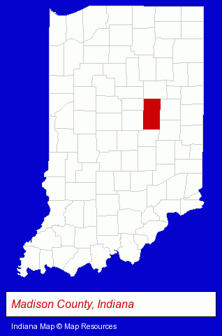
The Indiana counties map at upper right shows Madison County, highlighted in red. Use the menu below to display interactive maps of Anderson, either in a frame on this page or in full-screen mode.
Use the menu below to display categorized Anderson directories.
| Anderson Products and Services Directory | ||
|---|---|---|
| Attorneys | Auto Service | Printing and Publishing |
Selected Anderson, Indiana Listings
These representative Anderson listings provide some insight into the city's cultural environment and economic climate.- Physicians & Surgeons
- Alternative Medicine
- Chiropractors
- Alternative Medicine Practitioners
- Event Planning
- Party Planning
- Restaurants
- Pizza Restaurants
- Take Out
- Auto Parts Retail
- Auto Glass Retail
- Auto Glass Replacement & Repair
- Car Service & Repair
- Auto Parts Retail
- Auto Accessories Retail
- Candy & Confectionery Retail
- Criminal Law Attorneys
- Family Law Attorneys
- Estate Planning & Administration Attorneys
- Divorce Attorneys
- Weddings
- Clothing Stores
- Wedding Services
- Bridal Shops & Services
- Bridal Supplies Retail
- Funeral Services
- Cemeteries & Memorial Parks
- Cemeteries & Crematories
- Pre-Arranged Funeral Plans
- Funeral Planning
- Clinics & Medical Centers
- Veterinarians
- Animal Hospitals
- Animal Health
- Sports & Recreation Facilities
- Health Clubs & Gyms
- Exercise & Fitness Classes & Instruction
- Fitness Consultants
- Corporate Business Attorneys
- Family Law Attorneys
- Estate Planning & Administration Attorneys
- Bankruptcy Attorneys
Nearby Indiana Cities and Towns *
- Carmel (14) - Carmel, Indiana demographics and directory.
- Fishers (5) - Fishers, Indiana demographics and maps.
- Indianapolis (110) - Indianapolis, Indiana products & services directory.
- Muncie (7) - Muncie, Indiana demographics and maps.
- Noblesville (9) - Noblesville, Indiana demographics and directory.
- Westfield (1) - Westfield, Indiana information and maps.
* Parenthesized numbers indicate economic activity levels.
Copyright © 2011-2026 RegionalDirectory.us. All rights reserved.