Decatur, Indiana Map and Directory
Regional Directory > States Menu > Indiana
 According to the United States Census Bureau, Decatur is a City that is located in Adams County, Indiana at 40.83 degrees North and 84.93 degrees West.
The city's time zone is America/Indiana/Indianapolis, and the city's primary telephone area code is 260.
The land area of Decatur is about 5.78 square miles, whereas the water area of the city is about 0.01 square miles.
Adams County's land area is about 339 square miles, so the city occupies about 1.7 percent of the county's total land area.
According to the United States Census Bureau, Decatur is a City that is located in Adams County, Indiana at 40.83 degrees North and 84.93 degrees West.
The city's time zone is America/Indiana/Indianapolis, and the city's primary telephone area code is 260.
The land area of Decatur is about 5.78 square miles, whereas the water area of the city is about 0.01 square miles.
Adams County's land area is about 339 square miles, so the city occupies about 1.7 percent of the county's total land area.
The Census Bureau estimates that Decatur had about 9,858 residents in 2019, which is approximately 1,706 people per square mile of land area.
According to recent American Community Survey data, the median household income in Decatur was about $45,149 per year.
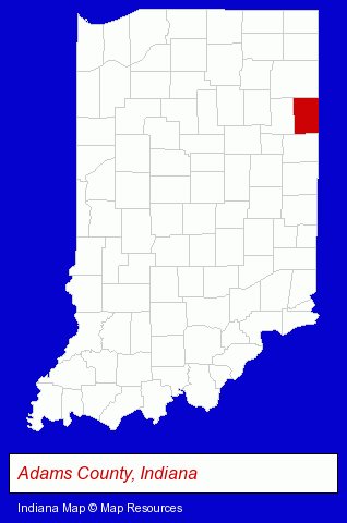
The Indiana counties map at upper right shows Adams County, highlighted in red. Use the menu below to display interactive maps of Decatur, either in a frame on this page or in full-screen mode.
Use the menu below to display categorized Decatur directories.
| Decatur Products and Services Directory | ||
|---|---|---|
| Auctions | Auto Service | Building Materials |
| Home Improvement | ||
Selected Decatur, Indiana Listings
These randomly selected Decatur listings provide some insight into the city's cultural environment and economic climate. Eichhorn Jewelry Inc- Clothing & Accessories Retail
- Jewelers
- General Real Estate
- Auctions
- Auctioneers & Auction Houses
- Landscape Contractors
- Truck Dealers
- Used Cars
- Used Trucks
- Schools
- Elementary & Secondary Education
- Elementary Schools
- Educational Services
- Restaurants
- Pizza Restaurants
Nearby Indiana Cities and Towns *
- Fort Wayne (29) - Fort Wayne, Indiana solutions directory and maps.
- Huntington (1) - Huntington, Indiana information and maps.
- Muncie (7) - Muncie, Indiana demographics and maps.
- Portland (1) - Portland, Indiana information and maps.
* Parenthesized numbers indicate economic activity levels.
Copyright © 2011-2026 RegionalDirectory.us. All rights reserved.