Portland, Indiana Map and Directory
Regional Directory > States Menu > Indiana
 According to the United States Census Bureau, Portland is a City that is located in Jay County, Indiana at 40.43 degrees North and 84.98 degrees West.
The city's time zone is America/Indiana/Indianapolis, and the city's primary telephone area code is 260.
The land area of Portland is about 4.97 square miles, whereas the water area of the city is about 0.00 square miles.
Jay County's land area is about 384 square miles, so the city occupies about 1.3 percent of the county's total land area.
According to the United States Census Bureau, Portland is a City that is located in Jay County, Indiana at 40.43 degrees North and 84.98 degrees West.
The city's time zone is America/Indiana/Indianapolis, and the city's primary telephone area code is 260.
The land area of Portland is about 4.97 square miles, whereas the water area of the city is about 0.00 square miles.
Jay County's land area is about 384 square miles, so the city occupies about 1.3 percent of the county's total land area.
The Census Bureau estimates that Portland had about 6,002 residents in 2019, which is approximately 1,208 people per square mile of land area.
According to recent American Community Survey data, the median household income in Portland was about $38,281 per year.
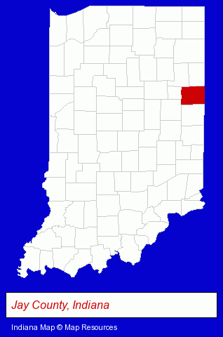
The Indiana counties map at upper right shows Jay County, highlighted in red. Use the menu below to display interactive maps of Portland, either in a frame on this page or in full-screen mode.
Use the menu below to display categorized Portland directories.
| Portland Directory Page: | Metals |
|---|
Selected Portland, Indiana Listings
These Portland listings provide some insight into the city's cultural environment and economic climate. Corle Insurance- Insurance
- Auto Insurance
- Property & Casualty Insurance
- Insurance Consultants & Advisors
- Credit Unions
- Schools
- Vocational Education
- Business Education
- Industrial & Trade Schools
- Secretarial Schools
- Charitable & Nonprofit Organizations
- Public Golf Courses
- Private Golf Courses
- Metal Finishing
Nearby Indiana Cities and Towns *
- Anderson (3) - Anderson, Indiana information and maps.
- Fort Wayne (29) - Fort Wayne, Indiana solutions directory and maps.
- Huntington (1) - Huntington, Indiana information and maps.
- Muncie (7) - Muncie, Indiana demographics and maps.
- Richmond (1) - Richmond, Indiana information and maps.
* Parenthesized numbers indicate economic activity levels.
Copyright © 2011-2026 RegionalDirectory.us. All rights reserved.