Colby, Kansas Map and Directory
Regional Directory > States Menu > Kansas
 According to the United States Census Bureau, Colby is a City that is located in Thomas County, Kansas at 39.40 degrees North and 101.05 degrees West.
The city's time zone is America/Chicago, and the city's primary telephone area code is 785.
The land area of Colby is about 3.52 square miles, whereas the water area of the city is about 0.00 square miles.
Thomas County's land area is about 1,075 square miles, so the city occupies about 0.3 percent of the county's total land area.
According to the United States Census Bureau, Colby is a City that is located in Thomas County, Kansas at 39.40 degrees North and 101.05 degrees West.
The city's time zone is America/Chicago, and the city's primary telephone area code is 785.
The land area of Colby is about 3.52 square miles, whereas the water area of the city is about 0.00 square miles.
Thomas County's land area is about 1,075 square miles, so the city occupies about 0.3 percent of the county's total land area.
The Census Bureau estimates that Colby had about 5,370 residents in 2019, which is approximately 1,526 people per square mile of land area.
According to recent American Community Survey data, the median household income in Colby was about $56,358 per year.
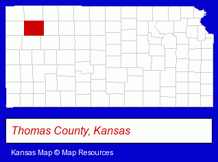
The Kansas counties map at upper right shows Thomas County, highlighted in red. Use the menu below to display interactive maps of Colby, either in a frame on this page or in full-screen mode.
Use the menu below to display categorized Colby directories.
| Colby Directory Page: | Grain Elevators |
|---|
Selected Colby, Kansas Listings
These Colby listings provide some insight into the city's cultural environment and economic climate.- Libraries
- Banks
- Mortgages
- Private Schools
- High Schools
- Christian Schools
- Jewelers
- Libraries
- Public Libraries
- Sporting Goods Dealers
- Sporting Goods
- Football Clubs & Instruction
- Hunting & Fishing Outfitters
- Truck Dealers
- Truck Equipment, Parts & Accessories Retail
- Utility Trailer Dealers
Nearby Kansas Cities and Towns *
- Garden City (4) - Garden City, Kansas information and maps.
- Great Bend (1) - Great Bend, Kansas information and maps.
- Hays (1) - Hays, Kansas information and maps.
- Hutchinson (9) - Hutchinson, Kansas demographics and directory.
- Manhattan (16) - Manhattan, Kansas demographics and directory.
- Salina (11) - Salina, Kansas demographics and directory.
- Wichita (109) - Wichita, Kansas products & services directory.
* Parenthesized numbers indicate economic activity levels.
Copyright © 2011-2026 RegionalDirectory.us. All rights reserved.