Hutchinson, Kansas Map and Directory
Regional Directory > States Menu > Kansas
 According to the United States Census Bureau, Hutchinson is a City that is located in Reno County, Kansas at 38.06 degrees North and 97.93 degrees West.
The city's time zone is America/Chicago, and the city's primary telephone area code is 620.
The land area of Hutchinson is about 24.64 square miles, whereas the water area of the city is about 0.06 square miles.
Reno County's land area is about 1,255 square miles, so the city occupies about 2.0 percent of the county's total land area.
According to the United States Census Bureau, Hutchinson is a City that is located in Reno County, Kansas at 38.06 degrees North and 97.93 degrees West.
The city's time zone is America/Chicago, and the city's primary telephone area code is 620.
The land area of Hutchinson is about 24.64 square miles, whereas the water area of the city is about 0.06 square miles.
Reno County's land area is about 1,255 square miles, so the city occupies about 2.0 percent of the county's total land area.
The Census Bureau estimates that Hutchinson had about 40,383 residents in 2019, which is approximately 1,639 people per square mile of land area.
According to recent American Community Survey data, the median household income in Hutchinson was about $46,927 per year.
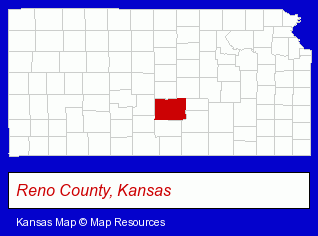
The Kansas counties map at upper right shows Reno County, highlighted in red. Use the menu below to display interactive maps of Hutchinson, either in a frame on this page or in full-screen mode.
Use the menu below to display categorized Hutchinson directories.
| Hutchinson Products and Services Directory | ||
|---|---|---|
| Building Materials | Clinics | Clothing Stores |
| Dentists | Home Improvement | Insurance |
| Physicians | Printing and Publishing | Schools |
Selected Hutchinson, Kansas Listings
These randomly selected Hutchinson listings provide some insight into the city's cultural environment and economic climate.- Auto Insurance
- Landscape Contractors
- Landscape Designers & Consultants
- Lawn & Garden Services
- Garden Centers
- Greenhouses
- Audio Equipment & Supplies Dealers
- Rental Stores & Yards
- Video Equipment, Parts & Supplies Retail
- Sound Equipment & Systems Sales, Rental & Leasing
- Audio & Video Recording Equipment & Supplies
- Government Contractors
- Textiles Retail
- Fabrics Wholesale & Manufacturers
- Cloth Bags
- Fruits & Vegetables Wholesale
- Meats Retail
- Fruits & Vegetables
- Frozen Food Processing
- Outdoor Sports & Recreation
- Camps
- Day Camps
- Accountants
- Certified Public Accountants
- Heating Contractors
- Air Conditioning Contractors
- Heating & Ventilating Contractors
- Furnaces & Heating Equipment Wholesale & Manufacturers
- Restaurants
- Barbecue Restaurants
- Printing Services
- Signs Wholesale & Manufacturers
- Hotels
- Building & Home Construction
- Builders & Contractors
- Roofing Contractors
- Roofing
Nearby Kansas Cities and Towns *
- Emporia (5) - Emporia, Kansas demographics and maps.
- Lindsborg (1) - Lindsborg, Kansas information and maps.
- Manhattan (16) - Manhattan, Kansas demographics and directory.
- Newton (2) - Newton, Kansas information and maps.
- Salina (11) - Salina, Kansas demographics and directory.
- Topeka (38) - Topeka, Kansas products & services directory.
- Wichita (109) - Wichita, Kansas products & services directory.
* Parenthesized numbers indicate economic activity levels.
Copyright © 2011-2026 RegionalDirectory.us. All rights reserved.