Parsons, Kansas Map and Directory
Regional Directory > States Menu > Kansas
 According to the United States Census Bureau, Parsons is a City that is located in Labette County, Kansas at 37.34 degrees North and 95.26 degrees West.
The city's time zone is America/Chicago, and the city's primary telephone area code is 620.
The land area of Parsons is about 10.61 square miles, whereas the water area of the city is about 0.09 square miles.
Labette County's land area is about 645 square miles, so the city occupies about 1.6 percent of the county's total land area.
According to the United States Census Bureau, Parsons is a City that is located in Labette County, Kansas at 37.34 degrees North and 95.26 degrees West.
The city's time zone is America/Chicago, and the city's primary telephone area code is 620.
The land area of Parsons is about 10.61 square miles, whereas the water area of the city is about 0.09 square miles.
Labette County's land area is about 645 square miles, so the city occupies about 1.6 percent of the county's total land area.
The Census Bureau estimates that Parsons had about 9,477 residents in 2019, which is approximately 893 people per square mile of land area.
According to recent American Community Survey data, the median household income in Parsons was about $39,949 per year.
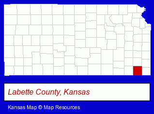
The Kansas counties map at upper right shows Labette County, highlighted in red. Use the menu below to display interactive maps of Parsons, either in a frame on this page or in full-screen mode.
Use the menu below to display categorized Parsons directories.
| Parsons Directory Page: | Physicians |
|---|
Selected Parsons, Kansas Listings
These Parsons listings provide some insight into the city's cultural environment and economic climate.- Insurance
- Health Insurance
- Sheet Metal Contractors
- Packaging & Shipping Materials Retail
- Sealers
- Schools
- Colleges & Universities
- Vocational Education
- Junior Colleges & Technical Institutes
- Photography
- Professional Photographers
- Wedding Photography & Videos
- Portrait & Commercial Photography
- Special Occasion Photography
- Auto Parts Retail
- Auto Accessories Retail
- Libraries
- Public Libraries
- Hospitals
- Family & General Practice Physicians & Surgeons
- Nursing & Convalescent Homes
- General Practice
- Rehabilitation Services
- General Practice
- Orthopedics Physicians & Surgeons
- Sports Medicine Physicians & Surgeons
- Rehabilitation Services
- General Practice
- Orthopedics Physicians & Surgeons
Nearby Kansas Cities and Towns *
- Burlington (1) - Burlington, Kansas information and maps.
- Emporia (5) - Emporia, Kansas demographics and maps.
- Fort Scott (1) - Fort Scott, Kansas information and maps.
- Gardner (2) - Gardner, Kansas information and maps.
- Olathe (28) - Olathe, Kansas solutions directory and maps.
* Parenthesized numbers indicate economic activity levels.
Copyright © 2011-2026 RegionalDirectory.us. All rights reserved.