Elizabethtown, Kentucky Map and Directory
Regional Directory > States Menu > Kentucky
 According to the United States Census Bureau, Elizabethtown is a City that is located in Hardin County, Kentucky at 37.69 degrees North and 85.86 degrees West.
The city's time zone is America/New York, and the city's primary telephone area code is 270.
The land area of Elizabethtown is about 27.02 square miles, whereas the water area of the city is about 0.49 square miles.
Hardin County's land area is about 623 square miles, so the city occupies about 4.3 percent of the county's total land area.
According to the United States Census Bureau, Elizabethtown is a City that is located in Hardin County, Kentucky at 37.69 degrees North and 85.86 degrees West.
The city's time zone is America/New York, and the city's primary telephone area code is 270.
The land area of Elizabethtown is about 27.02 square miles, whereas the water area of the city is about 0.49 square miles.
Hardin County's land area is about 623 square miles, so the city occupies about 4.3 percent of the county's total land area.
The Census Bureau estimates that Elizabethtown had about 30,289 residents in 2019, which is approximately 1,121 people per square mile of land area.
According to recent American Community Survey data, the median household income in Elizabethtown was about $46,754 per year. This Elizabethtown Real Estate directory lists real estate solution providers in Elizabethtown, Kentucky.
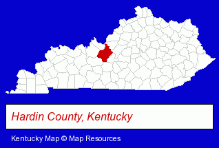
The Kentucky counties map at upper right shows Hardin County, highlighted in red. Use the menu below to display interactive maps of Elizabethtown, either in a frame on this page or in full-screen mode.
Use the menu below to display categorized Elizabethtown directories.
| Elizabethtown Products and Services Directory | ||
|---|---|---|
| Dentists | Home Improvement | Physicians |
Selected Elizabethtown, Kentucky Listings
These representative Elizabethtown listings provide some insight into the city's cultural environment and economic climate.- Restaurants
- Steak Restaurants
- Office Supplies Retail
- Gift Shops
- Stationery Retail
- Electric & Electronic Equipment & Supplies
- Consumer Electronics Stores
- Electric Equipment & Supplies Dealers
- Electric Equipment & Supplies Wholesale & Manufacturers
- Lighting Retail
- Alternative Medicine
- Chiropractors
- Alternative Medicine Practitioners
- Army & Navy Stores
- Paintball Facilities
- Military Supplies Wholesale & Manufacturers
- Pest Control Services
- Termite Control
- Utilities
- Water & Sewage Companies
- Water Utility Companies
- General Real Estate
- Auctions
- Auctioneers & Auction Houses
- Visual Arts
- Photography
- Professional Photographers
- Information Technology Services
- Computer Consultants
- Computer Systems Consultants & Designers
Nearby Kentucky Cities and Towns *
- Bowling Green (11) - Bowling Green, Kentucky demographics and directory.
- Hodgenville (1) - Hodgenville, Kentucky information and maps.
- La Grange (1) - La Grange, Kentucky information and maps.
- Louisville (92) - Louisville, Kentucky products & services directory.
- Owensboro (6) - Owensboro, Kentucky demographics and maps.
- Prospect (1) - Prospect, Kentucky information and maps.
- Shelbyville (2) - Shelbyville, Kentucky information and maps.
* Parenthesized numbers indicate economic activity levels.
Copyright © 2011-2026 RegionalDirectory.us. All rights reserved.