Louisville, Kentucky Map and Directory
Regional Directory > States Menu > Kentucky
 According to the United States Census Bureau, Louisville is a City that is located in Jefferson County, Kentucky at 38.25 degrees North and 85.76 degrees West.
The city's time zone is America/New York, and the city's primary telephone area code is 502.
The land area of Louisville is about 61.44 square miles, whereas the water area of the city is about 4.86 square miles.
Jefferson County's land area is about 380 square miles, so the city occupies about 16.2 percent of the county's total land area.
According to the United States Census Bureau, Louisville is a City that is located in Jefferson County, Kentucky at 38.25 degrees North and 85.76 degrees West.
The city's time zone is America/New York, and the city's primary telephone area code is 502.
The land area of Louisville is about 61.44 square miles, whereas the water area of the city is about 4.86 square miles.
Jefferson County's land area is about 380 square miles, so the city occupies about 16.2 percent of the county's total land area.
The Census Bureau estimates that Louisville had about 617,638 residents in 2019, which is approximately 10,053 people per square mile of land area.
According to recent American Community Survey data, the median household income in Louisville was about $53,436 per year. This Louisville Real Estate directory lists real estate solution providers in Louisville, Kentucky.
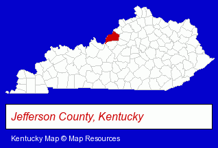
The Kentucky counties map at upper right shows Jefferson County, highlighted in red. Use the menu below to display interactive maps of Louisville, either in a frame on this page or in full-screen mode.
Use the menu below to display categorized Louisville directories.
Selected Louisville, Kentucky Listings
These randomly selected Louisville listings provide some insight into the city's cultural environment and economic climate.- Steel Distributors & Service Centers
- Criminal Law Attorneys
- Family Law Attorneys
- Alternative Medicine
- Chiropractors
- Alternative Medicine Practitioners
- Cosmetic Dentists
- Pet Care Services
- Animal Shelters
- Pet Related Services
- Humane Societies
- Food Products Wholesale & Manufacturers
- Food Processing & Manufacturers
- Surgical Instruments Wholesale & Manufacturers
- Chemicals Wholesale & Manufacturers
- Concrete & Concrete Products Dealers
- Food Products Wholesale & Manufacturers
- Seafood Restaurants
- Fish & Seafood Retail
- Fish & Seafood Wholesalers
- Accounting, Auditing & Bookkeeping Services
- Agricultural Equipment & Supplies Retail
- Farm Equipment & Supplies Dealers
- Farm Equipment & Parts Wholesale & Manufacturers
- Metal Products
- Metal Products Wholesale & Manufacturers
- Steel Fabrication
- Commercial & Industrial Building Contractors
Nearby Kentucky Cities and Towns *
- Elizabethtown (3) - Elizabethtown, Kentucky information and maps.
- Frankfort (4) - Frankfort, Kentucky information and maps.
- Hodgenville (1) - Hodgenville, Kentucky information and maps.
- La Grange (1) - La Grange, Kentucky information and maps.
- Lexington (39) - Lexington, Kentucky products & services directory.
- Prospect (1) - Prospect, Kentucky information and maps.
- Shelbyville (2) - Shelbyville, Kentucky information and maps.
Large and Mid-size Cities in Nearby States
- New Albany, Indiana (7) - New Albany, IN demographics and maps.
* Parenthesized numbers indicate economic activity levels.
Copyright © 2011-2026 RegionalDirectory.us. All rights reserved.