Eunice, Louisiana Map and Directory
Regional Directory > States Menu > Louisiana
 According to the United States Census Bureau, Eunice is a City that is located primarily in St. Landry Parish, Louisiana at 30.49 degrees North and 92.42 degrees West.
The city's time zone is America/Chicago, and the city's primary telephone area code is 337.
The land area of Eunice is about 5.14 square miles, whereas the water area of the city is about 0.00 square miles.
According to the United States Census Bureau, Eunice is a City that is located primarily in St. Landry Parish, Louisiana at 30.49 degrees North and 92.42 degrees West.
The city's time zone is America/Chicago, and the city's primary telephone area code is 337.
The land area of Eunice is about 5.14 square miles, whereas the water area of the city is about 0.00 square miles.
The Census Bureau estimates that Eunice had about 9,814 residents in 2019, which is approximately 1,909 people per square mile of land area.
According to recent American Community Survey data, the median household income in Eunice was about $34,573 per year.
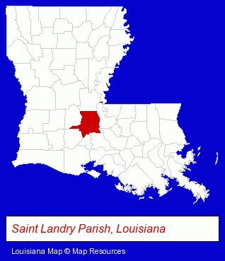
The Louisiana counties map at upper right shows St. Landry Parish, highlighted in red. Use the menu below to display interactive maps of Eunice, either in a frame on this page or in full-screen mode.
Use the menu below to display categorized Eunice directories.
| Eunice Directory Page: | Schools |
|---|
Selected Eunice, Louisiana Listings
These Eunice listings in zipcode 70535 provide a window into the city's cultural environment and economic climate. ACPS- Drug Stores & Pharmacies
- Pharmaceutical Products Wholesale & Manufacturers
- Hardware Dealers
- Welding Equipment & Supplies Retail
- Commercial Printing
- Newspaper Publishers
- Book Publishers
- Books & Magazines Wholesale & Distribution
- Newspaper Distributors
- Door & Window Dealers
- Door & Door Frame Dealers
- Ceramic Tiles
- Paint Stores
- Floor Resurfacing Materials
- Optometrists
- Optical Goods Retail
- Contact Lenses
- Auto Service & Repair
- Auto Transmissions
- Auto Oil & Lube
- Auto Air Conditioning & Heating Service & Repair
- Printing Services
- Screen Printing
- Clothing Wholesale & Manufacturers
- T-Shirts Retail
- Uniforms Commercial & Industrial
- Metals
- Welding Services
- Welding Contractors
- Landscape Contractors
- Tree Services Commercial & Industrial
Nearby Louisiana Cities and Towns *
- Alexandria (9) - Alexandria, Louisiana demographics and directory.
- Baton Rouge (95) - Baton Rouge, Louisiana products & services directory.
- Houma (13) - Houma, Louisiana demographics and directory.
- Lafayette (47) - Lafayette, Louisiana products & services directory.
- Lake Charles (18) - Lake Charles, Louisiana solutions directory and maps.
- New Iberia (5) - New Iberia, Louisiana demographics and maps.
* Parenthesized numbers indicate economic activity levels.
Copyright © 2011-2026 RegionalDirectory.us. All rights reserved.