Adams, Massachusetts Map and Directory
Regional Directory > States Menu > Massachusetts
 According to the United States Census Bureau, Adams is a Town that is located in Berkshire County, Massachusetts at 42.63 degrees North and 73.12 degrees West.
The town's time zone is America/New York, and the town's primary telephone area code is 413.
The land area of Adams is about 22.89 square miles, whereas the water area of the town is about 0.07 square miles.
Berkshire County's land area is about 927 square miles, so the town occupies about 2.5 percent of the county's total land area.
According to the United States Census Bureau, Adams is a Town that is located in Berkshire County, Massachusetts at 42.63 degrees North and 73.12 degrees West.
The town's time zone is America/New York, and the town's primary telephone area code is 413.
The land area of Adams is about 22.89 square miles, whereas the water area of the town is about 0.07 square miles.
Berkshire County's land area is about 927 square miles, so the town occupies about 2.5 percent of the county's total land area.
The Census Bureau estimates that Adams had about 8,125 residents in 2019, which is approximately 355 people per square mile of land area.
According to recent American Community Survey data, the median household income in Adams was about $53,070 per year.
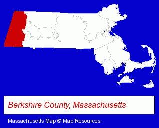
The Massachusetts counties map at upper right shows Berkshire County, highlighted in red. Use the menu below to display interactive maps of Adams, either in a frame on this page or in full-screen mode.
Use the menu below to display categorized Adams directories.
| Adams Directory Page: | Restaurants |
|---|
Selected Adams, Massachusetts Listings
These Adams listings provide some insight into the town's cultural environment and economic climate.- Bed & Breakfasts
- Pet Care Services
- Pet Sitting & Day Care
- Pet Related Services
- Camps
- Canoe & Kayak Rental & Leasing
- Energy & Environment
- Building Materials & Supplies Wholesale & Manufacturers
- Solar Energy Systems & Services Retail
- Solar Energy Contractors
- Builders & Contractors
- Building Contractors
- Bicycle Dealers
- Motorcycle, Motor Scooter & Minibike Parts & Accessories
- Importers
- Chemicals Wholesale & Manufacturers
- Chemicals Wholesale & Manufacturers
- Chemicals - Manufacturers
- Engineers
- Electric & Electronic Equipment & Supplies
- Electric Equipment & Supplies Dealers
- Electric Wire & Cable
- Manufacturing Engineers
- Metal Products Wholesale & Manufacturers
- Insurance
- Museums
- Machine Shops
- Machine Tools Wholesale & Manufacturing
- Landscape Contractors
- Garden Centers
Nearby Massachusetts Cities and Towns *
- Great Barrington (4) - Great Barrington, Massachusetts information and maps.
- Lenox (3) - Lenox, Massachusetts information and maps.
- Northampton (8) - Northampton, Massachusetts demographics and maps.
- Pittsfield (9) - Pittsfield, Massachusetts demographics and directory.
- Sheffield (2) - Sheffield, Massachusetts information and maps.
- Springfield (18) - Springfield, Massachusetts solutions directory and maps.
- Williamstown (2) - Williamstown, Massachusetts information and maps.
* Parenthesized numbers indicate economic activity levels.
Copyright © 2011-2026 RegionalDirectory.us. All rights reserved.