Northampton, Massachusetts Map and Directory
Regional Directory > States Menu > Massachusetts
 According to the United States Census Bureau, Northampton is a City that is located in Hampshire County, Massachusetts at 42.33 degrees North and 72.64 degrees West.
The city's time zone is America/New York, and the city's primary telephone area code is 413.
The land area of Northampton is about 34.24 square miles, whereas the water area of the city is about 1.51 square miles.
Hampshire County's land area is about 527 square miles, so the city occupies about 6.5 percent of the county's total land area.
According to the United States Census Bureau, Northampton is a City that is located in Hampshire County, Massachusetts at 42.33 degrees North and 72.64 degrees West.
The city's time zone is America/New York, and the city's primary telephone area code is 413.
The land area of Northampton is about 34.24 square miles, whereas the water area of the city is about 1.51 square miles.
Hampshire County's land area is about 527 square miles, so the city occupies about 6.5 percent of the county's total land area.
The Census Bureau estimates that Northampton had about 28,451 residents in 2019, which is approximately 831 people per square mile of land area.
According to recent American Community Survey data, the median household income in Northampton was about $66,522 per year.
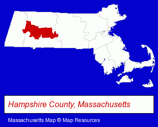
The Massachusetts counties map at upper right shows Hampshire County, highlighted in red. Use the menu below to display interactive maps of Northampton, either in a frame on this page or in full-screen mode.
Use the menu below to display categorized Northampton directories.
| Northampton Products and Services Directory | ||
|---|---|---|
| Attorneys | Auto Service | Building Contractors |
| Dentists | Insurance | Physicians |
| Restaurants | Visual Arts | |
Selected Northampton, Massachusetts Listings
These randomly selected Northampton listings provide some insight into the city's cultural environment and economic climate.- Toy Stores
- General Stores
- Commercial Printing
- Commercial & Graphic Artists
- Invitations & Announcements
- Catalogs & Brochures
- Arbitration & Mediation Services
- Arbitration & Mediation Services Attorneys
- Arbitrators
- Architects
- Architectural Engineers
- Libraries
- Public Libraries
- Schools
- Public Schools
- Educational Services
- Educational Consultants
- Clinics & Medical Centers
- Employment
- Employment Agencies
- Recruitment & Staffing Services
- Executive Search Consultants
- Personal Injury Attorneys
- Accident Attorneys
- Airports
- Bars & Pubs
- Pubs
- Veterinarians
- Animal Hospitals
- Animal Health
- Small Animal Veterinarians
- Surgery Veterinarians
- Information Technology Services
- Computer Software
- Adult & Continuing Education
- Computer Training
- Radio Stations
Nearby Massachusetts Cities and Towns *
- Amherst (9) - Amherst, Massachusetts demographics and directory.
- Chicopee (2) - Chicopee, Massachusetts information and maps.
- Hadley (2) - Hadley, Massachusetts information and maps.
- Holyoke (4) - Holyoke, Massachusetts information and maps.
- South Hadley (2) - South Hadley, Massachusetts information and maps.
- Springfield (18) - Springfield, Massachusetts solutions directory and maps.
- Westfield (5) - Westfield, Massachusetts demographics and maps.
* Parenthesized numbers indicate economic activity levels.
Copyright © 2011-2026 RegionalDirectory.us. All rights reserved.