Chelsea, Massachusetts Map and Directory
Regional Directory > States Menu > Massachusetts
 According to the United States Census Bureau, Chelsea is a City that is located in Suffolk County, Massachusetts at 42.39 degrees North and 71.03 degrees West.
The city's time zone is America/New York, and the city's primary telephone area code is 857.
The land area of Chelsea is about 2.21 square miles, whereas the water area of the city is about 0.25 square miles.
Suffolk County's land area is about 58 square miles, so the city occupies about 3.8 percent of the county's total land area.
According to the United States Census Bureau, Chelsea is a City that is located in Suffolk County, Massachusetts at 42.39 degrees North and 71.03 degrees West.
The city's time zone is America/New York, and the city's primary telephone area code is 857.
The land area of Chelsea is about 2.21 square miles, whereas the water area of the city is about 0.25 square miles.
Suffolk County's land area is about 58 square miles, so the city occupies about 3.8 percent of the county's total land area.
The Census Bureau estimates that Chelsea had about 39,690 residents in 2019, which is approximately 17,959 people per square mile of land area.
According to recent American Community Survey data, the median household income in Chelsea was about $56,802 per year.
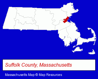
The Massachusetts counties map at upper right shows Suffolk County, highlighted in red. Use the menu below to display interactive maps of Chelsea, either in a frame on this page or in full-screen mode.
Use the menu below to display categorized Chelsea directories.
| Chelsea Directory Page: | Fruits and Vegetables |
|---|
Selected Chelsea, Massachusetts Listings
These Chelsea listings provide some insight into the city's cultural environment and economic climate.- Building & Home Construction
- Architects
- Architectural Services
- Importers
- Exporters
- Clothing Wholesale & Manufacturers
- Fur Clothing Wholesale & Manufacturers
- Fruits & Vegetables Retail
- Fruits & Vegetables Wholesale
- Fruits & Vegetables
- Fruits & Vegetables Retail
- Fruits & Vegetables Wholesale
- Fruits & Vegetables Wholesale
- Fruits & Vegetables
- Fruits & Vegetables Retail
- Meats Wholesale
- Jewelry Repair
- Pawn Brokers & Shops
- Insurance
- Attorneys
- Divorce Attorneys
- Immigration Law Attorneys
- Government Contractors
- Adult & Continuing Education
- Computer Training
- Hotels
- Motels
- Banquet Facilities
- Convention & Meeting Facilities & Services
- Wedding Receptions & Parties
- Fruits & Vegetables Retail
- Fruits & Vegetables Wholesale
- Florists
- Home Improvement & Maintenance
- Industrial Equipment & Supplies Dealers
- Electric & Electronic Equipment & Supplies
- Plumbing Service & Repair
- Electric Motor Dealers
Nearby Massachusetts Cities and Towns *
- Boston (96) - Boston, Massachusetts products & services directory.
- Cambridge (33) - Cambridge, Massachusetts products & services directory.
- Malden (3) - Malden, Massachusetts information and maps.
- Medford (6) - Medford, Massachusetts demographics and maps.
- Melrose (3) - Melrose, Massachusetts information and maps.
- Saugus (3) - Saugus, Massachusetts information and maps.
- Somerville (9) - Somerville, Massachusetts demographics and directory.
Large and Mid-size Cities in Nearby States
- Salem, New Hampshire (14) - Salem, NH demographics and directory.
* Parenthesized numbers indicate economic activity levels.
Copyright © 2011-2026 RegionalDirectory.us. All rights reserved.