Melrose, Massachusetts Map and Directory
Regional Directory > States Menu > Massachusetts
 According to the United States Census Bureau, Melrose is a City that is located in Middlesex County, Massachusetts at 42.46 degrees North and 71.07 degrees West.
The city's time zone is America/New York, and the city's primary telephone area code is 339.
The land area of Melrose is about 4.68 square miles, whereas the water area of the city is about 0.08 square miles.
Middlesex County's land area is about 818 square miles, so the city occupies about 0.6 percent of the county's total land area.
According to the United States Census Bureau, Melrose is a City that is located in Middlesex County, Massachusetts at 42.46 degrees North and 71.07 degrees West.
The city's time zone is America/New York, and the city's primary telephone area code is 339.
The land area of Melrose is about 4.68 square miles, whereas the water area of the city is about 0.08 square miles.
Middlesex County's land area is about 818 square miles, so the city occupies about 0.6 percent of the county's total land area.
The Census Bureau estimates that Melrose had about 28,016 residents in 2019, which is approximately 5,986 people per square mile of land area.
According to recent American Community Survey data, the median household income in Melrose was about $106,955 per year.
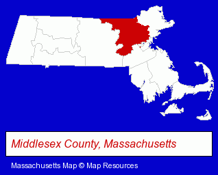
The Massachusetts counties map at upper right shows Middlesex County, highlighted in red. Use the menu below to display interactive maps of Melrose, either in a frame on this page or in full-screen mode.
Use the menu below to display categorized Melrose directories.
| Melrose Products and Services Directory | ||
|---|---|---|
| Dentists | Florists | Physicians |
Selected Melrose, Massachusetts Listings
These representative Melrose listings provide some insight into the city's cultural environment and economic climate.- Chiropractors
- Mental Health Practitioners
- Psychologists
- General Practice
- Orthodontics Dentists
- Electronic Equipment & Supplies Retail
- Electronic Equipment & Supplies Service & Repair
- Electronic Testing Equipment Dealers
- Attorneys
- Freight Forwarding
- Freight Trucking
- Pet Food & Supplies Retail
- Banks
- Financial Institutions
- Maxillofacial Physicians & Surgeons
- Floral & Balloon Arrangements
- Health Information & Referral Services
Nearby Massachusetts Cities and Towns *
- Malden (3) - Malden, Massachusetts information and maps.
- Medford (6) - Medford, Massachusetts demographics and maps.
- Saugus (3) - Saugus, Massachusetts information and maps.
- Stoneham (3) - Stoneham, Massachusetts information and maps.
- Wakefield (9) - Wakefield, Massachusetts demographics and directory.
- Winchester (5) - Winchester, Massachusetts demographics and maps.
- Woburn (19) - Woburn, Massachusetts solutions directory and maps.
Large and Mid-size Cities in Nearby States
- Salem, New Hampshire (14) - Salem, NH demographics and directory.
* Parenthesized numbers indicate economic activity levels.
Copyright © 2011-2026 RegionalDirectory.us. All rights reserved.