Fall River, Massachusetts Map and Directory
Regional Directory > States Menu > Massachusetts
 According to the United States Census Bureau, Fall River is a City that is located in Bristol County, Massachusetts at 41.70 degrees North and 71.16 degrees West.
The city's time zone is America/New York, and the city's primary telephone area code is 774.
The land area of Fall River is about 33.13 square miles, whereas the water area of the city is about 7.11 square miles.
Bristol County's land area is about 553 square miles, so the city occupies about 6.0 percent of the county's total land area.
According to the United States Census Bureau, Fall River is a City that is located in Bristol County, Massachusetts at 41.70 degrees North and 71.16 degrees West.
The city's time zone is America/New York, and the city's primary telephone area code is 774.
The land area of Fall River is about 33.13 square miles, whereas the water area of the city is about 7.11 square miles.
Bristol County's land area is about 553 square miles, so the city occupies about 6.0 percent of the county's total land area.
The Census Bureau estimates that Fall River had about 89,541 residents in 2019, which is approximately 2,703 people per square mile of land area.
According to recent American Community Survey data, the median household income in Fall River was about $43,503 per year.
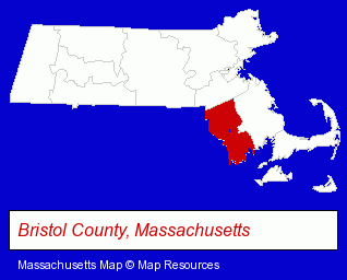
The Massachusetts counties map at upper right shows Bristol County, highlighted in red. Use the menu below to display interactive maps of Fall River, either in a frame on this page or in full-screen mode.
Use the menu below to display categorized Fall River directories.
| Fall River Products and Services Directory | ||
|---|---|---|
| Attorneys | Auto Service | Building Materials |
| Dentists | Financial Services | Home Improvement |
| Insurance | Orthopedists | Physicians |
| Restaurants | ||
Selected Fall River, Massachusetts Listings
These randomly selected Fall River listings provide some insight into the city's cultural environment and economic climate.- Accountants
- Tax Return Preparation & Electronic Filing
- Payroll & Payroll Tax Preparation Services
- Tax Consultants
- Income Tax Services
- Dermatology Physicians & Surgeons
- Dermatology Pediatrics Physicians & Surgeons
- Dermatology Podiatry Physicians & Surgeons
- Social Security Attorneys
- Lawyers - Employment & Labor Law
- Disability Law Attorneys
- Lawyers - Social Security & Government Law
- Auto Engine Service & Repair
- Tires Retail
- Auto Alignment, Frame & Axle Service & Repair
- Electric Tools
- Medical Equipment & Supplies Retail
- Hospital Supplies
- Dental Clinics
- Electric Equipment & Supplies Wholesale & Manufacturers
- Public Golf Courses
- Private Golf Courses
- Private Golf Clubs
- Bakeries
- Security Systems & Services
- Loan & Financing Services
- Investigation Services
- Detective Agencies
- Florists
- Factory Outlets
- Notaries Public
- Textiles Wholesale & Manufacturers
- Jewelers
- Jewelry Repair
- Metal Fabricators
- Sheet Metal Wholesale & Manufacturers
- American Restaurants
- Bar & Grill Restaurants
- Mexican Restaurants
Nearby Massachusetts Cities and Towns *
- Attleboro (7) - Attleboro, Massachusetts demographics and maps.
- New Bedford (15) - New Bedford, Massachusetts demographics and directory.
- Raynham (2) - Raynham, Massachusetts information and maps.
- Rehoboth (1) - Rehoboth, Massachusetts information and maps.
- Seekonk (2) - Seekonk, Massachusetts information and maps.
- Taunton (6) - Taunton, Massachusetts demographics and maps.
- Westport (1) - Westport, Massachusetts information and maps.
* Parenthesized numbers indicate economic activity levels.
Copyright © 2011-2026 RegionalDirectory.us. All rights reserved.