Raynham, Massachusetts Map and Directory
Regional Directory > States Menu > Massachusetts
 According to the United States Census Bureau, Raynham is a Town that is located in Bristol County, Massachusetts at 41.93 degrees North and 71.05 degrees West.
The town's time zone is America/New York, and the town's primary telephone area code is 774.
The land area of Raynham is about 20.49 square miles, whereas the water area of the town is about 0.30 square miles.
Bristol County's land area is about 553 square miles, so the town occupies about 3.7 percent of the county's total land area.
According to the United States Census Bureau, Raynham is a Town that is located in Bristol County, Massachusetts at 41.93 degrees North and 71.05 degrees West.
The town's time zone is America/New York, and the town's primary telephone area code is 774.
The land area of Raynham is about 20.49 square miles, whereas the water area of the town is about 0.30 square miles.
Bristol County's land area is about 553 square miles, so the town occupies about 3.7 percent of the county's total land area.
The Census Bureau estimates that Raynham had about 14,196 residents in 2019, which is approximately 693 people per square mile of land area.
According to recent American Community Survey data, the median household income in Raynham was about $100,938 per year.
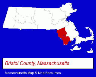
The Massachusetts counties map at upper right shows Bristol County, highlighted in red. Use the menu below to display interactive maps of Raynham, either in a frame on this page or in full-screen mode.
Use the menu below to display categorized Raynham directories.
| Raynham Products and Services Directory | |
|---|---|
| Building Materials | Physicians |
Selected Raynham, Massachusetts Listings
These representative Raynham listings provide some insight into the town's cultural environment and economic climate.- Clothing Stores
- Police Departments
- Uniforms Commercial & Industrial
- Uniforms Retail
- Alternative Medicine
- Chiropractors
- Alternative Medicine Practitioners
- Baking Products
- Pediatrics Dentists
- Building Materials & Supplies Wholesale & Manufacturers
- Landscape Equipment & Supplies Dealers
- Masonry Equipment & Supplies
- Auto Service & Repair
- Auto Buyers
- Family & General Practice Physicians & Surgeons
- Beauty Salons
- Manicures & Pedicures
- Utilities
- Water & Sewage Companies
- Water Utility Companies
- Farm Equipment & Supplies Dealers
- Lawn Mowers Retail
- Agricultural Tractor Dealers
- Pet Care Services
- Pet Training
- Animals Specialty Services
- General Practice
- Kitchen & Bathroom Remodeling
- Bathroom Planning & Remodeling
- Mental Health
- Counseling Services
- Psychologists
- Health Care Professionals
- Mental Health Counselors
- Dry Cleaners
- Business Brokers
- Business Brokers
Nearby Massachusetts Cities and Towns *
- Brockton (15) - Brockton, Massachusetts demographics and directory.
- Fall River (10) - Fall River, Massachusetts demographics and directory.
- Mansfield (2) - Mansfield, Massachusetts information and maps.
- Norwood (10) - Norwood, Massachusetts demographics and directory.
- Stoughton (8) - Stoughton, Massachusetts demographics and maps.
- Taunton (6) - Taunton, Massachusetts demographics and maps.
- Whitman (1) - Whitman, Massachusetts information and maps.
Large and Mid-size Cities in Nearby States
- Providence, Rhode Island (27) - Providence, RI solutions directory and maps.
* Parenthesized numbers indicate economic activity levels.
Copyright © 2011-2026 RegionalDirectory.us. All rights reserved.