Woburn, Massachusetts Map and Directory
Regional Directory > States Menu > Massachusetts
 According to the United States Census Bureau, Woburn is a City that is located in Middlesex County, Massachusetts at 42.48 degrees North and 71.15 degrees West.
The city's time zone is America/New York, and the city's primary telephone area code is 339.
The land area of Woburn is about 12.64 square miles, whereas the water area of the city is about 0.31 square miles.
Middlesex County's land area is about 818 square miles, so the city occupies about 1.5 percent of the county's total land area.
According to the United States Census Bureau, Woburn is a City that is located in Middlesex County, Massachusetts at 42.48 degrees North and 71.15 degrees West.
The city's time zone is America/New York, and the city's primary telephone area code is 339.
The land area of Woburn is about 12.64 square miles, whereas the water area of the city is about 0.31 square miles.
Middlesex County's land area is about 818 square miles, so the city occupies about 1.5 percent of the county's total land area.
The Census Bureau estimates that Woburn had about 40,228 residents in 2019, which is approximately 3,183 people per square mile of land area.
According to recent American Community Survey data, the median household income in Woburn was about $91,022 per year.
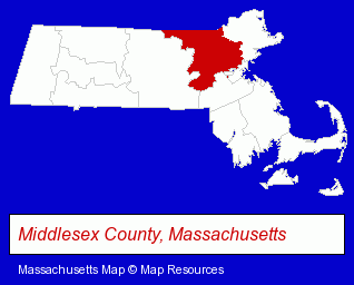
The Massachusetts counties map at upper right shows Middlesex County, highlighted in red. Use the menu below to display interactive maps of Woburn, either in a frame on this page or in full-screen mode.
Use the menu below to display categorized Woburn directories.
| Woburn Products and Services Directory | ||
|---|---|---|
| Accountants | Attorneys | Auto Service |
| Building Materials | Business Services | Electric Companies |
| Home Improvement | Information Technology | Insurance |
| Plumbing Contractors | Printing and Publishing | |
Selected Woburn, Massachusetts Listings
These randomly selected Woburn listings provide some insight into the city's cultural environment and economic climate.- HVAC Equipment & Supplies Dealers
- Plumbing & Heating Supplies Retail
- Heating Equipment Parts & Supplies Dealers
- Heating Equipment Wholesale & Manufacturers
- Dentists
- Cosmetic Dentists
- Periodontics Dentists
- Oral Surgeons
- Divorce Attorneys
- Divorce & Mediation Services
- Custody & Support Law Attorneys
- Divorce Counseling & Mediation
- Builders & Contractors
- Building Contractors
- Bathroom Planning & Remodeling
- Industrial Equipment & Supplies Dealers
- Medical Equipment & Supplies Retail
- Building & Home Construction
- Building Remodeling & Repair Contractors
- Plastering, Dry Wall & Insulation
- Drywall Contractors
- Drywall Repair
- Investigation Services
- Office Supplies Retail
- Electric Equipment & Supplies Dealers
- Electric Companies
- Engineers
- Mechanical Engineers
- Rehabilitation Services
- Chiropractors
Nearby Massachusetts Cities and Towns *
- Arlington (10) - Arlington, Massachusetts demographics and directory.
- Burlington (11) - Burlington, Massachusetts demographics and directory.
- Lexington (8) - Lexington, Massachusetts demographics and maps.
- Medford (6) - Medford, Massachusetts demographics and maps.
- Melrose (3) - Melrose, Massachusetts information and maps.
- Stoneham (3) - Stoneham, Massachusetts information and maps.
- Winchester (5) - Winchester, Massachusetts demographics and maps.
Large and Mid-size Cities in Nearby States
- Salem, New Hampshire (14) - Salem, NH demographics and directory.
* Parenthesized numbers indicate economic activity levels.
Copyright © 2011-2026 RegionalDirectory.us. All rights reserved.