Nantucket, Massachusetts Map and Directory
Regional Directory > States Menu > Massachusetts
 According to the United States Census Bureau, Nantucket is a Town that is located in Nantucket County, Massachusetts at 41.29 degrees North and 70.10 degrees West.
The town's time zone is America/New York, and the town's primary telephone area code is 774.
The land area of Nantucket is about 46.11 square miles, whereas the water area of the town is about 59.15 square miles.
Nantucket County's land area is about 45 square miles, so the town occupies about 102.5 percent of the county's total land area.
According to the United States Census Bureau, Nantucket is a Town that is located in Nantucket County, Massachusetts at 41.29 degrees North and 70.10 degrees West.
The town's time zone is America/New York, and the town's primary telephone area code is 774.
The land area of Nantucket is about 46.11 square miles, whereas the water area of the town is about 59.15 square miles.
Nantucket County's land area is about 45 square miles, so the town occupies about 102.5 percent of the county's total land area.
The Census Bureau estimates that Nantucket had about 11,168 residents in 2019, which is approximately 242 people per square mile of land area.
According to recent American Community Survey data, the median household income in Nantucket was about $107,717 per year.
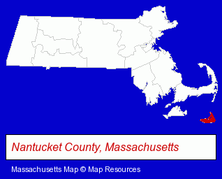
The Massachusetts counties map at upper right shows Nantucket County, highlighted in red. Use the menu below to display interactive maps of Nantucket, either in a frame on this page or in full-screen mode.
Use the menu below to display categorized Nantucket directories.
| Nantucket Products and Services Directory | ||
|---|---|---|
| Attorneys | Hotels | Restaurants |
| Seafood Restaurants | ||
Selected Nantucket, Massachusetts Listings
These randomly selected Nantucket listings provide some insight into the town's cultural environment and economic climate.- Dry Cleaners
- Estate Planning & Administration Attorneys
- Real Estate Attorneys
- Lodging
- Hotels
- Bed & Breakfasts
- Bed & Breakfast Reservations
- Builders & Contractors
- Building Contractors
- Lawn & Garden Equipment & Supplies Retail
- Agricultural Equipment & Supplies Retail
- Farm Equipment & Supplies Dealers
- Bicycle Repair & Maintenance
- Bicycle Rental
- Corporate Business Attorneys
- Real Estate Attorneys
- Civil Law Attorneys
- Bakeries
- Bathroom Planning & Remodeling
- Shower Doors & Enclosures Retail
- Banks
- Caterers
- Seafood Restaurants
- Baking Products
- Dentists
- Utilities
- Water & Sewage Companies
- Water Utility Companies
Nearby Massachusetts Cities and Towns *
- Brewster (1) - Brewster, Massachusetts information and maps.
- Chatham (4) - Chatham, Massachusetts information and maps.
- Dennis Port (2) - Dennis Port, Massachusetts information and maps.
- Edgartown (2) - Edgartown, Massachusetts information and maps.
- Harwich (1) - Harwich, Massachusetts information and maps.
- South Dennis (1) - South Dennis, Massachusetts information and maps.
- South Yarmouth (1) - South Yarmouth, Massachusetts information and maps.
* Parenthesized numbers indicate economic activity levels.
Copyright © 2011-2026 RegionalDirectory.us. All rights reserved.