Edgartown, Massachusetts Map and Directory
Regional Directory > States Menu > Massachusetts
 According to the United States Census Bureau, Edgartown is a Town that is located in Dukes County, Massachusetts at 41.37 degrees North and 70.48 degrees West.
The town's time zone is America/New York, and the town's primary telephone area code is 774.
The land area of Edgartown is about 26.82 square miles, whereas the water area of the town is about 95.98 square miles.
Dukes County's land area is about 103 square miles, so the town occupies about 26.0 percent of the county's total land area.
According to the United States Census Bureau, Edgartown is a Town that is located in Dukes County, Massachusetts at 41.37 degrees North and 70.48 degrees West.
The town's time zone is America/New York, and the town's primary telephone area code is 774.
The land area of Edgartown is about 26.82 square miles, whereas the water area of the town is about 95.98 square miles.
Dukes County's land area is about 103 square miles, so the town occupies about 26.0 percent of the county's total land area.
The Census Bureau estimates that Edgartown had about 4,308 residents in 2014, which is approximately 161 people per square mile of land area.
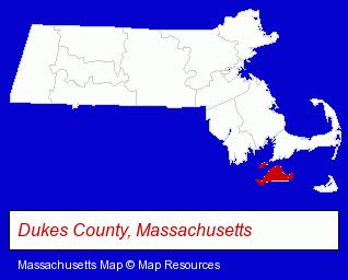
The Massachusetts counties map at upper right shows Dukes County, highlighted in red. Use the menu below to display interactive maps of Edgartown, either in a frame on this page or in full-screen mode.
Use the menu below to display categorized Edgartown directories.
| Edgartown Products and Services Directory | |
|---|---|
| Hotels | Restaurants |
Selected Edgartown, Massachusetts Listings
These representative Edgartown listings provide some insight into the town's cultural environment and economic climate.- Seafood Restaurants
- American Restaurants
- Take Out
- Family Restaurants
- Fast Food Restaurants
- Lodging
- Hotels
- Motels
- Sports & Recreation Facilities
- Health Clubs & Gyms
- Lodging
- Hotels
- Motels
- Landscape Contractors
- Caterers
- Clambake Caterers
- Charitable & Nonprofit Organizations
- Visual Arts
- Art Galleries & Dealers
- Schools
- Printing & Publishing
- Publishers
- Newspaper Publishers
- Private Golf Courses
Nearby Massachusetts Cities and Towns *
- Nantucket (4) - Nantucket, Massachusetts information and maps.
- New Bedford (15) - New Bedford, Massachusetts demographics and directory.
- Plymouth (16) - Plymouth, Massachusetts demographics and directory.
- Sandwich (3) - Sandwich, Massachusetts information and maps.
* Parenthesized numbers indicate economic activity levels.
Copyright © 2011-2026 RegionalDirectory.us. All rights reserved.