Plymouth, Massachusetts Map and Directory
Regional Directory > States Menu > Massachusetts
 According to the United States Census Bureau, Plymouth is a Town that is located in Plymouth County, Massachusetts at 41.90 degrees North and 70.62 degrees West.
The town's time zone is America/New York, and the town's primary telephone area code is 774.
The land area of Plymouth is about 96.45 square miles, whereas the water area of the town is about 37.51 square miles.
Plymouth County's land area is about 659 square miles, so the town occupies about 14.6 percent of the county's total land area.
According to the United States Census Bureau, Plymouth is a Town that is located in Plymouth County, Massachusetts at 41.90 degrees North and 70.62 degrees West.
The town's time zone is America/New York, and the town's primary telephone area code is 774.
The land area of Plymouth is about 96.45 square miles, whereas the water area of the town is about 37.51 square miles.
Plymouth County's land area is about 659 square miles, so the town occupies about 14.6 percent of the county's total land area.
The Census Bureau estimates that Plymouth had about 60,024 residents in 2019, which is approximately 622 people per square mile of land area.
According to recent American Community Survey data, the median household income in Plymouth was about $90,279 per year.
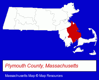
The Massachusetts counties map at upper right shows Plymouth County, highlighted in red. Use the menu below to display interactive maps of Plymouth, either in a frame on this page or in full-screen mode.
Use the menu below to display categorized Plymouth directories.
| Plymouth Products and Services Directory | ||
|---|---|---|
| Accountants | Attorneys | Auto Service |
| Building Contractors | Building Materials | Camps |
| Construction Companies | Dentists | Financial Services |
| Home Improvement | Information Technology | Insurance |
| Metal Finishing | Orthodontics Dentists | Physicians |
| Schools | ||
Selected Plymouth, Massachusetts Listings
These randomly selected Plymouth listings provide some insight into the town's cultural environment and economic climate.- Metal Stamping
- Hotels
- Motels
- Sports Camps
- Florists
- Motion Picture Production Services & Facilities
- Video Production Services Commercial
- Videotape Editing
- Metals
- Metal Finishing
- Printing & Publishing
- Masonry Contractors
- Masonry Equipment & Supplies
- Engineers
- Civil Engineers
- Construction Engineers
- Environmental Engineers
- Engineers
- Medical Equipment & Supplies Retail
- Engineering Services
- Parking Garages
- Candy & Confectionery Retail
- Mental Health
- Clinics
- Builders & Contractors
- Building Contractors
- Orthodontics Dentists
- Beauty Salons
- Barbers
- Manicures & Pedicures
- Oil & Gas Companies
Nearby Massachusetts Cities and Towns *
- Buzzards Bay (1) - Buzzards Bay, Massachusetts information and maps.
- Pembroke (1) - Pembroke, Massachusetts information and maps.
- Sandwich (3) - Sandwich, Massachusetts information and maps.
- Wareham (1) - Wareham, Massachusetts information and maps.
* Parenthesized numbers indicate economic activity levels.
Copyright © 2011-2026 RegionalDirectory.us. All rights reserved.